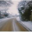
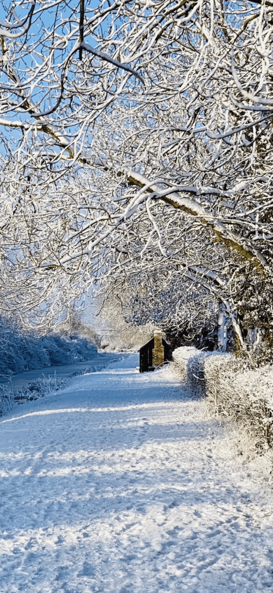
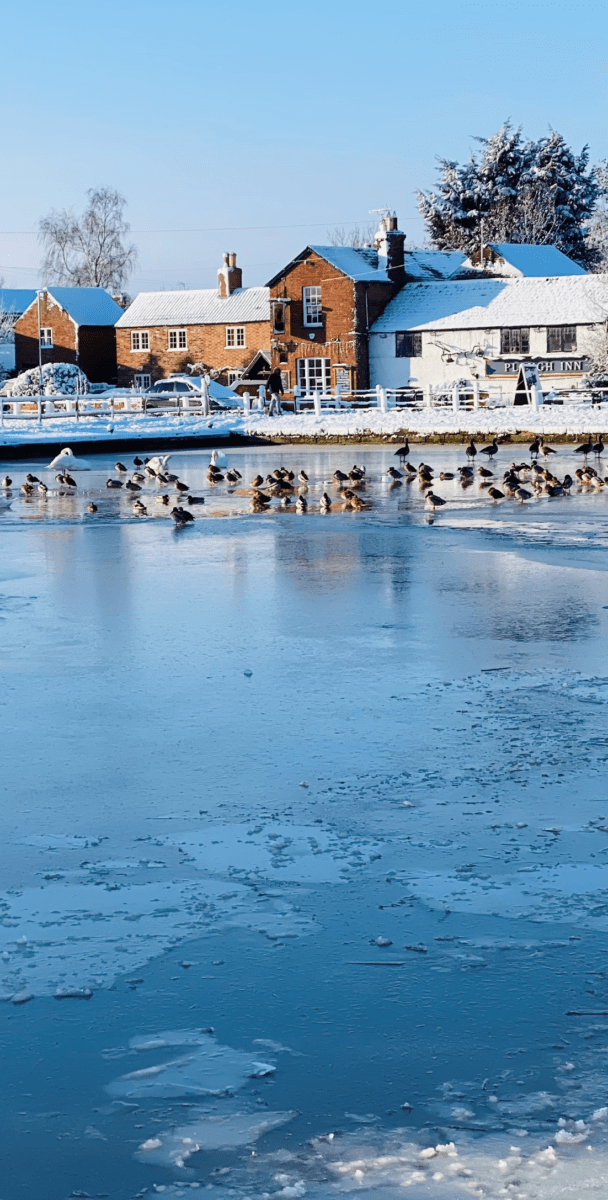
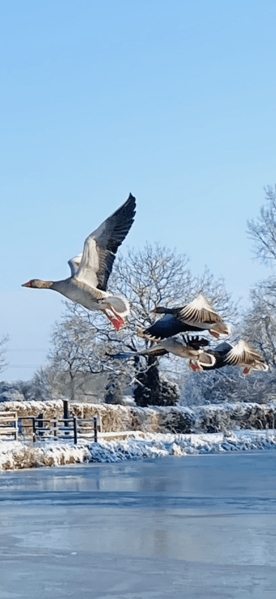
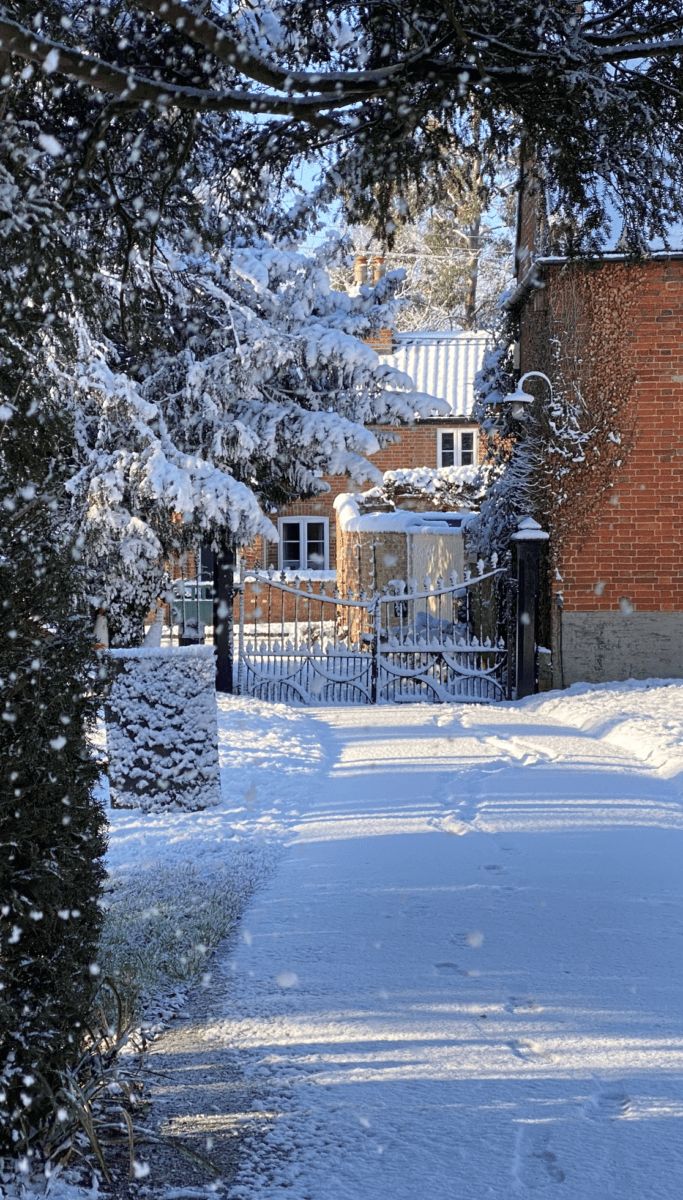
Snowy January (25th Jan 2021)
Hickling is located just below the Belvoir Escarpment – steep hills which surround (and define) the Vale of Belvoir. This means that the village sometimes seems to have its own micro-climate; it can be foggy or snowy or wet here but not a few miles down the road (and vice versa). There is no doubt that if rain comes down suddenly or quickly then it streams down from the Hickling Standard hills with immediate impacts in the village itself (even with modern drainage systems). The area is surrounded by small springs (for example, as you descend Bridegate Hill) and, not so long ago, there were natural ponds dotting the surrounding fields. Until well into the nineteenth century, the village was largely inaccessible during the winter months and residents needed to be as self-sufficient as possible.
“The village lied in a miry part of the county and consists of about 70 dwellings; the roads to it are intolerable in the winter. The road from the Fosse to the village is in a right line, very spacious, at the distance of about half a mile. The village, or rather the lanes leading to it, are a labyrinth, the way I entered it. The numerous passages, open to the more numerous inclosures adjoining the village, misguide you: the trees in the hedgerows are lofty, many and meet each other, which made the passages gloomy and miry, and some them almost impassable.”
(Robert Thoroton ‘The Antiquities of Nottinghamshire’ 1790-96 & The Scrapbook of Hickling by Hazel Wadkin )
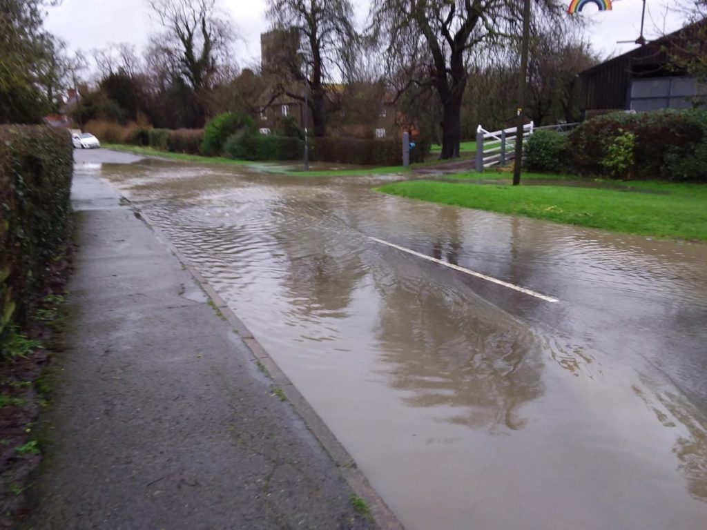
Flooding .
Flooding (19/1/2021 GB)
Two rivers/streams run through the village – the Smite and the Dalby Brook (plus, of course, the canal which overspills into the waterways at the culvert just beyond the Basin). The Smite begins at Holwell Mouth as a series of springs. This is a great place on the right as you approach the top of Clawson hill which was visited in the 17th & 18th centuries because the reddish, ironstone waters were thought to have healing powers. It then flows under the Clawson to Nether Broughton road and then under Clawson Lane half way between Hickling and Clawson where it forms the Notts/Leics border. The Smite then passes under the canal half a mile later and meanders towards Colston Bassett. You can tell by the little old cliffs here that it used to be much bigger. The Dalby Brook originates in the horseshoe of hills between Old Dalby, Upper Broughton and Hickling Pastures. It joins the River Smite (which is now the smaller watercourse) about half a mile before Colston Bassett. Colston Bassett used to have a port! Can you believe that? The Smite then carries on towards Whatton and Aslockton (where it has long flooded heavily) where it is joined by the Whipling and then joins the Devon (which starts near Belvoir) before joining the Trent at Newark.
“In the 17th century the river was known as the Snite. This and the modern spelling are thought to derive from the Old English word smita, denoting a foul or miry place. This is linked to another Old English word smitan, which means to daub or pollute”
(Mutschmann. CUP)
And:
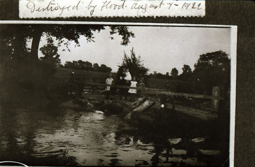
“Hickling has always been known for flooding. Outside Waterlane Farm, Church Farm, Bridegate Lane corner, Clawson lane where the Dalby brook runs under the road and at the top of Faulks’ Lane were, and indeed still are, the places affected by flooding after continuous rain.
“On August Bank Holiday 1922 the Church and the Chapel flood joined and the water reached the front doorstep of Rose Cottage and the top step of Yew Tree House opposite, the bridge over the brook on Clawson Lane was washed away. A number of houses had water in the downstairs rooms, animals and poultry were drowned. Although the floods have joined a number of times since this was the highest water level anyone can remember.”
(Scrapbook of Hickling by Hazel Wadkin )
Flooding: February 2020
Flooding east of the village - Clawson Lane to Canal Basin (16th Feb 2020)
Flooding east of the village - Clawson Lane to Canal Basin (16th Feb 2020)
Looking up Long Lane towards the Standard Feb 2020
Looking up Long Lane towards the Standard Feb 2020
Flooding (Feb 2020) Cesterern, Main St and Waterlane Farm
Flooding (Feb 2020) Cesterern, Main St and Waterlane Farm
Pudding Lane Feb 2020
Pudding Lane Feb 2020
Pudding Lane to the Brook Feb 2020
Pudding Lane to the Brook Feb 2020
Flooding (Feb 2020) end of Harles Acres 1
Flooding (Feb 2020) end of Harles Acres 1
Flooding (Feb 2020) end of Harles Acres 2
Flooding (Feb 2020) end of Harles Acres 2
Flooding east of the village - Clawson Lane to Canal Basin (16th Feb 2020)
Flooding east of the village - Clawson Lane to Canal Basin (16th Feb 2020)
Flooding east of the village - Clawson Lane to Canal Basin (16th Feb 2020)
Flooding east of the village - Clawson Lane to Canal Basin (16th Feb 2020)
Flooding east of the village - Clawson Lane to Canal Basin (16th Feb 2020)
Flooding east of the village - Clawson Lane to Canal Basin (16th Feb 2020)
Flooding east of the village - Clawson Lane to Canal Basin (16th Feb 2020)
Flooding east of the village - Clawson Lane to Canal Basin (16th Feb 2020)
Flooding east of the village - Clawson Lane to Canal Basin (16th Feb 2020)
Flooding east of the village - Clawson Lane to Canal Basin (16th Feb 2020)
Flooding east of the village - Clawson Lane to Canal Basin (16th Feb 2020)
Flooding east of the village - Clawson Lane to Canal Basin (16th Feb 2020)
Flooding east of the village - Clawson Lane to Canal Basin (16th Feb 2020)
Flooding east of the village - Clawson Lane to Canal Basin (16th Feb 2020)
Flooding east of the village - Clawson Lane to Canal Basin (16th Feb 2020)
Flooding east of the village - Clawson Lane to Canal Basin (16th Feb 2020)
Flooding east of the village - Clawson Lane to Canal Basin (16th Feb 2020)
Flooding east of the village - Clawson Lane to Canal Basin (16th Feb 2020)
Prev 1 of16 Next
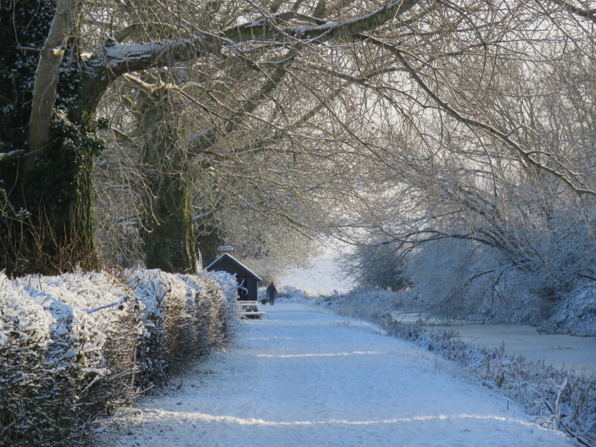
Snow and Ice.
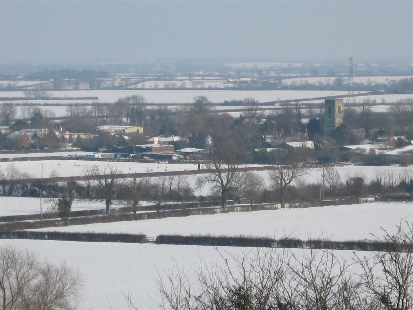
Hickling in the snow (3rd Feb 2009 from the trig point)
There is no doubt that we no longer have the huge downfalls of snow or the weeks of ice that were characteristic of winters past. Nevertheless, a good downfall of snow brings out the sledges on the Standards and beautiful winter transformations – even if it’s just for a day-or-two. We are looking to build a series of galleries of Hickling in the snow; if you have pictures and anecdotes, please get in touch and we will add them, below:
January 2021:
January 2021 threw everything at Hickling (and the rest of the UK, too): Covid-19, Brexit, floods, Storm Christoff and snow:
Snowy January (25th Jan 2021) Snowy January (25th Jan 2021)
Snowy January (25th Jan 2021) Snowy January (25th Jan 2021)
Snowy January (25th Jan 2021) Snowy January (25th Jan 2021)
Snowy January (25th Jan 2021)
Snowy January (25th Jan 2021)
Snowy January (25th Jan 2021)
Snowy January (25th Jan 2021)
Snowy January (C. Wadkin 25th Jan 2021)
Snowy January (C. Wadkin 25th Jan 2021)
Snowy January (C. Wadkin 25th Jan 2021)
Snowy January (C. Wadkin 25th Jan 2021)
Snowy January (C. Wadkin 25th Jan 2021)
Snowy January (C. Wadkin 25th Jan 2021)
Snowy January (C. Wadkin 25th Jan 2021)
Snowy January (C. Wadkin 25th Jan 2021)
Snowy January (C. Wadkin 25th Jan 2021)
Snowy January (C. Wadkin 25th Jan 2021)
Snowy January (25th Jan 2021)
Snowy January (25th Jan 2021)
Snowy January (25th Jan 2021)
Snowy January (25th Jan 2021)
Snowy January (25th Jan 2021)
Snowy January (25th Jan 2021)
Snowy January (25th Jan 2021)
Snowy January (25th Jan 2021)
Snowy January (25th Jan 2021)
Snowy January (25th Jan 2021)
Snowy January (25th Jan 2021)
Snowy January (25th Jan 2021)
Snowy January (25th Jan 2021)
Snowy January (25th Jan 2021)
Snowy January (25th Jan 2021)
Snowy January (25th Jan 2021)
Snowy January (25th Jan 2021)
Snowy January (25th Jan 2021)
Snowy January (25th Jan 2021)
Snowy January (25th Jan 2021)
Snowy January (25th Jan 2021)
Snowy January (25th Jan 2021)
Snowy January (25th Jan 2021)
Snowy January (25th Jan 2021)
Snowy January (25th Jan 2021)
Snowy January (25th Jan 2021)
Snowy January (25th Jan 2021)
Snowy January (25th Jan 2021)
Snowy January (25th Jan 2021)
Snowy January (25th Jan 2021)
Snowy January (25th Jan 2021)
Snowy January (25th Jan 2021)
Snowy January (25th Jan 2021)
Snowy January (25th Jan 2021)
Snowy January (25th Jan 2021)
Snowy January (25th Jan 2021)
Snowy January (25th Jan 2021)
Snowy January (25th Jan 2021)
Snowy January (25th Jan 2021)
Snowy January (25th Jan 2021)
Snowy January (25th Jan 2021)
Snowy January (25th Jan 2021)
Snowy January (25th Jan 2021)
Snowy January (25th Jan 2021)
Snowy January (25th Jan 2021)
Snowy January (25th Jan 2021)
Snowy January (25th Jan 2021)
Snowy January (25th Jan 2021)
Snowy January (25th Jan 2021)
Snowy January (25th Jan 2021)
Snowy January (25th Jan 2021)
Snowy January (25th Jan 2021)
Snowy January (25th Jan 2021)
Snowy January (25th Jan 2021)
Snowy January (25th Jan 2021)
Snowy January (25th Jan 2021)
Snowy January (25th Jan 2021)
Snowy January (25th Jan 2021)
Snowy January (25th Jan 2021)
Snowy January (25th Jan 2021)
Snowy January (25th Jan 2021)
Snowy January (25th Jan 2021)
Snowy January (25th Jan 2021)
Snowy January (25th Jan 2021)
Snowy January (25th Jan 2021)
Snowy January (25th Jan 2021)
Snowy January (25th Jan 2021)
Snowy January (25th Jan 2021)
Snowy January (25th Jan 2021)
Snowy January (25th Jan 2021)
Snowy January (25th Jan 2021)
Snowy January (25th Jan 2021)
Snowy January (25th Jan 2021)
Snowy January (25th Jan 2021)
Snowy January (25th Jan 2021)
Snowy January (25th Jan 2021)
Snowy January (25th Jan 2021)
Snowy January (25th Jan 2021)
Snowy January (25th Jan 2021)
Snowy January (25th Jan 2021)
Snowy January (25th Jan 2021)
Snowy January (25th Jan 2021)
Snowy January (25th Jan 2021)
Snowy January (25th Jan 2021)
Snowy January (25th Jan 2021)
Snowy January (25th Jan 2021)
Snowy January (25th Jan 2021)
Snowy January (25th Jan 2021)
Snowy January (25th Jan 2021)
Snowy January (25th Jan 2021)
Snowy January (25th Jan 2021)
Snowy January (25th Jan 2021)
Snowy January (25th Jan 2021)
Snowy January (25th Jan 2021)
Snowy January (25th Jan 2021)
Snowy January (25th Jan 2021)
Snowy January (25th Jan 2021)
Snowy January (25th Jan 2021)
Snowy January (25th Jan 2021)
Snowy January (25th Jan 2021)
Snowy January (25th Jan 2021)
Snowy January (25th Jan 2021)
Snowy January (25th Jan 2021)
Snowy January (25th Jan 2021)
Snowy January (25th Jan 2021)
Snowy January (25th Jan 2021)
Snowy January (25th Jan 2021)
Snowy January (25th Jan 2021)
Snowy January (25th Jan 2021)
Snowy January (25th Jan 2021)
Snowy January (25th Jan 2021)
Snowy January (25th Jan 2021)
Snowy January (25th Jan 2021)
Snowy January (25th Jan 2021)
Snowy January (25th Jan 2021)
Snowy January (25th Jan 2021)
Snowy January (25th Jan 2021)
Snowy January (25th Jan 2021)
Snowy January (25th Jan 2021)
Snowy January (25th Jan 2021)
Snowy January (25th Jan 2021)
Snowy January (25th Jan 2021)
Snowy January (25th Jan 2021)
Snowy January (25th Jan 2021)
Snowy January (25th Jan 2021)
Snowy January (25th Jan 2021)
Snowy January (25th Jan 2021)
Snowy January (25th Jan 2021)
Snowy January (25th Jan 2021)
Snowy January (25th Jan 2021)
Snowy January (25th Jan 2021)
Snowy January (25th Jan 2021)
Snowy January (25th Jan 2021)
Snowy January (25th Jan 2021)
Snowy January (25th Jan 2021)
Snowy January (25th Jan 2021)
Snowy January (25th Jan 2021)
Snowy January (25th Jan 2021)
Snowy January (25th Jan 2021)
Snowy January (25th Jan 2021)
Snowy January (25th Jan 2021)
Snowy January (25th Jan 2021)
Snowy January (25th Jan 2021)
Snowy January (25th Jan 2021)
Snowy January (25th Jan 2021)
Snowy January (25th Jan 2021)
Snowy January (25th Jan 2021)
Snowy January (25th Jan 2021)
Snowy January (25th Jan 2021)
Snowy January (25th Jan 2021)
Snowy January (25th Jan 2021)
Snowy January (25th Jan 2021)
Snowy January (25th Jan 2021)
Snowy January (25th Jan 2021)
Snowy January (25th Jan 2021)
Snowy January (25th Jan 2021)
Snowy January (25th Jan 2021)
Snowy January (25th Jan 2021)
Snowy January (25th Jan 2021)
Snowy January (25th Jan 2021)
Snowy January (25th Jan 2021)
Snowy January (25th Jan 2021)
Snowy January (25th Jan 2021)
Snowy January (25th Jan 2021)
Snowy January (25th Jan 2021)
Snowy January (25th Jan 2021)
Snowy January (25th Jan 2021)
Snowy January (25th Jan 2021)
Snowy January (25th Jan 2021)
Snowy January (25th Jan 2021)
Snowy January (25th Jan 2021)
Snowy January (25th Jan 2021)
Snowy January (25th Jan 2021)
Snowy January (25th Jan 2021)
Snowy January (25th Jan 2021)
Snowy January (25th Jan 2021)
Snowy January (25th Jan 2021)
Snowy January (25th Jan 2021)
Snowy January (25th Jan 2021)
Snowy January (25th Jan 2021)
Snowy January (25th Jan 2021)
Snowy January (25th Jan 2021)
Snowy January (25th Jan 2021)
Snowy January (25th Jan 2021)
Snowy January (25th Jan 2021)
Snowy January (25th Jan 2021)
Snowy January (25th Jan 2021)
Snowy January (25th Jan 2021)
Snowy January (25th Jan 2021)
Snowy January (25th Jan 2021)
Snowy January (25th Jan 2021)
Snowy January (25th Jan 2021)
Snowy January (25th Jan 2021)
Snowy January (25th Jan 2021)
Snowy January (25th Jan 2021)
Snowy January (25th Jan 2021)
Snowy January (25th Jan 2021)
Snowy January (25th Jan 2021)
Snowy January (25th Jan 2021)
Snowy January (25th Jan 2021)
Snowy January (25th Jan 2021)
Snowy January (25th Jan 2021)
Snowy January (25th Jan 2021)
Snowy January (25th Jan 2021)
Snowy January (25th Jan 2021)
Snowy January (25th Jan 2021)
Snowy January (25th Jan 2021)
Snowy January (25th Jan 2021)
Snowy January (25th Jan 2021)
Snowy January (25th Jan 2021)
Snowy January (25th Jan 2021)
Snowy January (25th Jan 2021)
Snowy January (25th Jan 2021)
Snowy January (25th Jan 2021)
Snowy January (25th Jan 2021)
Snowy January (25th Jan 2021)
Snowy January (25th Jan 2021)
Snowy January (25th Jan 2021)
Snowy January (25th Jan 2021)
Snowy January (25th Jan 2021)
Snowy January (25th Jan 2021)
Snowy January (25th Jan 2021)
Prev 1 of118 Next
Rainbow over Hickling Canal Basin (15/6/24)
Rainbow over Hickling Basin 150624 (© V Baker – all rights reserved)
Rainbow over Hickling Basin 150624 (© V Baker – all rights reserved)
Rainbow over Hickling Basin 150624 (© V Baker – all rights reserved)
Please note: this is a large gallery and may take a little while to load to your screen.
This gallery is from the Wadkin Archives
W0063 Kinoulton rd. (JL Laws sketch & snow)
W0063 Kinoulton rd. (JL Laws sketch & snow)
W0063a Kinoulton rd. (JL Laws sketch & snow)
W0063a Kinoulton rd. (JL Laws sketch & snow)
W0063b Kinoulton rd. (JL Laws sketch & snow)
W0063b Kinoulton rd. (JL Laws sketch & snow)
W0063bb Kinoulton rd. (JL Laws sketch & snow)
W0063bb Kinoulton rd. (JL Laws sketch & snow)
W0071 Main St in the snow (1979 & 1997)
W0071 Main St in the snow (1979 & 1997)
W0071a Main St in the snow (1979)
W0071a Main St in the snow (1979)
W0071aa Main St in the snow (1979)
W0071aa Main St in the snow (1979)
W0071b Main St in the snow (1997)
W0071b Main St in the snow (1997)
W0080 Snow 1979
W0080 Snow 1979
W0080a Snow 1979
W0080a Snow 1979
W0080aa Snow 1979
W0080aa Snow 1979
W0080b Snow 1979
W0080b Snow 1979
W0080bb Snow 1979
W0080bb Snow 1979
W0081 Flooding: W0081 to W0107
W0081 Flooding: W0081 to W0107
W0082 Flooding - Church Farm 1922 & 2001
W0082 Flooding - Church Farm 1922 & 2001
W0082a Flooding - Church Farm 1922
W0082a Flooding - Church Farm 1922
W0082aa Flooding - Church Farm 1922
W0082aa Flooding - Church Farm 1922
W0082b Flooding - Church Farm 2001
W0082b Flooding - Church Farm 2001
W0082bb Flooding - Church Farm 2001
W0082bb Flooding - Church Farm 2001
W0083 Flooding - Waterlane Farm 2001
W0083 Flooding - Waterlane Farm 2001
W0083a Flooding - Waterlane Farm 2001
W0083a Flooding - Waterlane Farm 2001
W0083b Flooding - Waterlane Farm 2001
W0083b Flooding - Waterlane Farm 2001
W0084 Flooding - Main St 2001
W0084 Flooding - Main St 2001
W0084a Flooding - Main St 2001
W0084a Flooding - Main St 2001
W0084aa Flooding - Main St 2001
W0084aa Flooding - Main St 2001
W0084b Flooding - Main St 2001
W0084b Flooding - Main St 2001
W0085 Flooding - Main St 1954 & 1968
W0085 Flooding - Main St 1954 & 1968
W0085a&b Flooding - Main St 1954
W0085a&b Flooding - Main St 1954
W0085a Flooding - Main St 1954
W0085a Flooding - Main St 1954
W0085aa Flooding - Main St 1954
W0085aa Flooding - Main St 1954
W0085b Flooding - Main St 1954
W0085b Flooding - Main St 1954
W0085bb Flooding - Main St 1954
W0085bb Flooding - Main St 1954
W0085c&d Flooding - Main St 1968
W0085c&d Flooding - Main St 1968
W0085c Flooding - Main St 1968
W0085c Flooding - Main St 1968
W0085cc Flooding - Main St 1968
W0085cc Flooding - Main St 1968
W0085d Flooding - Main St 1968
W0085d Flooding - Main St 1968
W0085dd Flooding - Main St
W0085dd Flooding - Main St
W0086 Flooding - school bus 2001
W0086 Flooding - school bus 2001
W0086a Flooding - school bus 2001
W0086a Flooding - school bus 2001
W0086b Flooding - school bus 2001
W0086b Flooding - school bus 2001
W0087 Flooding - Main St 2001
W0087 Flooding - Main St 2001
W0087a Flooding - Main St 2001
W0087a Flooding - Main St 2001
W0087b Flooding - Main St 2001
W0087b Flooding - Main St 2001
W0087bb Flooding - Main St 2001
W0087bb Flooding - Main St 2001
W0088 Flooding - Main St 1975
W0088 Flooding - Main St 1975
W0088a Flooding - Main St 1975
W0088a Flooding - Main St 1975
W0088b Flooding - Main St 1975
W0088b Flooding - Main St 1975
W0088c Flooding - Main St 1975
W0088c Flooding - Main St 1975
W0088d Flooding - Main St 1975
W0088d Flooding - Main St 1975
W0089 Flooding - Bridegate Lane 2001
W0089 Flooding - Bridegate Lane 2001
W0089a Flooding - Bridegate Lane 2001
W0089a Flooding - Bridegate Lane 2001
W0089aa Flooding - Bridegate Lane 2001
W0089aa Flooding - Bridegate Lane 2001
W0089b Flooding - Bridegate Lane 2001
W0089b Flooding - Bridegate Lane 2001
W0089bb Flooding - Bridegate Lane 2001
W0089bb Flooding - Bridegate Lane 2001
W0090 Flooding - Dalby Brook bridge pre-1922
W0090 Flooding - Dalby Brook bridge pre-1922
W0090a Flooding - Dalby Brook bridge pre-1922
W0090a Flooding - Dalby Brook bridge pre-1922
W0090aa Flooding - Dalby Brook bridge pre-1922
W0090aa Flooding - Dalby Brook bridge pre-1922
W0091 Flooding - Dalby Brook 1922
W0091 Flooding - Dalby Brook 1922
W0091a Flooding - Dalby Brook 1922
W0091a Flooding - Dalby Brook 1922
W0091aa Flooding - Dalby Brook 1922
W0091aa Flooding - Dalby Brook 1922
W0091b Flooding - Dalby Brook 1922
W0091b Flooding - Dalby Brook 1922
W0091bb Flooding - Dalby Brook 1922
W0091bb Flooding - Dalby Brook 1922
W0092 Flooding - The Green 2001
W0092 Flooding - The Green 2001
W0092a Flooding - The Green 2001
W0092a Flooding - The Green 2001
W0092aa Flooding - The Green 2001
W0092aa Flooding - The Green 2001
W0092b Flooding - The Green 2001
W0092b Flooding - The Green 2001
W0092c Flooding - The Green 2001
W0092c Flooding - The Green 2001
W0092cc Flooding - The Green 2001
W0092cc Flooding - The Green 2001
W0093 Flooding - Harles Acres 2001
W0093 Flooding - Harles Acres 2001
W0093a Flooding - Harles Acres 2001
W0093a Flooding - Harles Acres 2001
W0093aa Flooding - Harles Acres 2001
W0093aa Flooding - Harles Acres 2001
W0093b Flooding - Harles Acres 2001
W0093b Flooding - Harles Acres 2001
W0094 Flooding - Dalby Brook/Canal 2001
W0094 Flooding - Dalby Brook/Canal 2001
W0094a Flooding - Dalby Brook/Canal 2001
W0094a Flooding - Dalby Brook/Canal 2001
W0094aa Flooding - Dalby Brook/Canal 2001
W0094aa Flooding - Dalby Brook/Canal 2001
W0095 Flooding - Waterlane Farm 1983
W0095 Flooding - Waterlane Farm 1983
W0095a Flooding - Waterlane Farm 1983
W0095a Flooding - Waterlane Farm 1983
W0095aa Flooding - Waterlane Farm 1983
W0095aa Flooding - Waterlane Farm 1983
W0095b Flooding - Waterlane Farm 1983
W0095b Flooding - Waterlane Farm 1983
W0095bb W0095b Flooding - Waterlane Farm 1983
W0095bb W0095b Flooding - Waterlane Farm 1983
W0096 Flooding - Waterlane Farm 2001
W0096 Flooding - Waterlane Farm 2001
W0096a Flooding - Waterlane Farm 2001
W0096a Flooding - Waterlane Farm 2001
W0096aa Flooding - Waterlane Farm 2001
W0096aa Flooding - Waterlane Farm 2001
W0097 Flooding - Waterlane Farm 1998
W0097 Flooding - Waterlane Farm 1998
W0097a Flooding - Waterlane Farm 1998
W0097a Flooding - Waterlane Farm 1998
W0097aa Flooding - Waterlane Farm 1998
W0097aa Flooding - Waterlane Farm 1998
W0097b Flooding - Waterlane Farm 1998
W0097b Flooding - Waterlane Farm 1998
W0097bb Flooding - Waterlane Farm 1998
W0097bb Flooding - Waterlane Farm 1998
W0098 Flooding - Waterlane Farm 1998
W0098 Flooding - Waterlane Farm 1998
W0098a Flooding - Waterlane Farm 1998
W0098a Flooding - Waterlane Farm 1998
W0098b Flooding - Waterlane Farm 1998
W0098b Flooding - Waterlane Farm 1998
W0099 Flooding - Waterlane Farm 2001
W0099 Flooding - Waterlane Farm 2001
W0099a Flooding - Waterlane Farm 2001
W0099a Flooding - Waterlane Farm 2001
W0099aa Flooding - Waterlane Farm 2001
W0099aa Flooding - Waterlane Farm 2001
W0099b Flooding - Waterlane Farm 2001
W0099b Flooding - Waterlane Farm 2001
W0100 Flooding - Waterlane Farm 2001
W0100 Flooding - Waterlane Farm 2001
W0100a Flooding - Waterlane Farm 2001
W0100a Flooding - Waterlane Farm 2001
W0100aa Flooding - Waterlane Farm 2001
W0100aa Flooding - Waterlane Farm 2001
W0100b Flooding - Waterlane Farm 2001
W0100b Flooding - Waterlane Farm 2001
W0101 Flooding - Main St Elm Farm 1983
W0101 Flooding - Main St Elm Farm 1983
W0101a Flooding - Main St Elm Farm 1983
W0101a Flooding - Main St Elm Farm 1983
W0101aa Flooding - Main St Elm Farm 1983
W0101aa Flooding - Main St Elm Farm 1983
W0102 Flooding - Main St 2001
W0102 Flooding - Main St 2001
W0102a Flooding - Main St 2001
W0102a Flooding - Main St 2001
W0102b Flooding - Main St 2001
W0102b Flooding - Main St 2001
W0103 Flooding - Bridegate Lane 2001
W0103 Flooding - Bridegate Lane 2001
W0103a Flooding - Bridegate Lane 2001
W0103a Flooding - Bridegate Lane 2001
W0103aa Flooding - Bridegate Lane 2001
W0103aa Flooding - Bridegate Lane 2001
W0103b Flooding - Bridegate Lane 2001
W0103b Flooding - Bridegate Lane 2001
W0104 Flooding - Dalby Brook & Waterlane Farm
W0104 Flooding - Dalby Brook & Waterlane Farm
W0104a Flooding - Dalby Brook & Waterlane Farm
W0104a Flooding - Dalby Brook & Waterlane Farm
W0104b Flooding - Dalby Brook & Waterlane Farm
W0104b Flooding - Dalby Brook & Waterlane Farm
W0105 Flooding - Clawson Lane aftermath 2001
W0105 Flooding - Clawson Lane aftermath 2001
W0105a Flooding - Clawson Lane aftermath 2001
W0105a Flooding - Clawson Lane aftermath 2001
W0105aa Flooding - Clawson Lane aftermath 2001
W0105aa Flooding - Clawson Lane aftermath 2001
W0106 Flooding - Clawson Lane 1998
W0106 Flooding - Clawson Lane 1998
W0106a Flooding - Clawson Lane 1998
W0106a Flooding - Clawson Lane 1998
W0107 Flooding - Harles Acres 2001
W0107 Flooding - Harles Acres 2001
W0107a Flooding - Harles Acres 2001
W0107a Flooding - Harles Acres 2001
W0107aa Flooding - Harles Acres 2001
W0107aa Flooding - Harles Acres 2001
W0107b Flooding - Harles Acres 2001
W0107b Flooding - Harles Acres 2001
W0128 Main St. towards Church (2001 & 1989)
W0128 Main St. towards Church (2001 & 1989)
W0128a Main St. towards Church (2001)
W0128a Main St. towards Church (2001)
W0128b Main St. towards Church (1989)
W0128b Main St. towards Church (1989)
W0138 Clawson Lane junction (1920s & 2005)
W0138 Clawson Lane junction (1920s & 2005)
W0138a Clawson Lane junction (1920s)
W0138a Clawson Lane junction (1920s)
W0138aa Clawson Lane junction (1920s)
W0138aa Clawson Lane junction (1920s)
W0138b Clawson Lane junction (2005)
W0138b Clawson Lane junction (2005)
W0138bb Clawson Lane junction (2005)
W0138bb Clawson Lane junction (2005)
W0239 Dalby Brook bridge on Clawson Lane 1922
W0239 Dalby Brook bridge on Clawson Lane 1922
W0239a Dalby Brook bridge on Clawson Lane 1922
W0239a Dalby Brook bridge on Clawson Lane 1922
W0239aa Dalby Brook bridge on Clawson Lane 1922
W0239aa Dalby Brook bridge on Clawson Lane 1922
W0239b Dalby Brook bridge on Clawson Lane 1922
W0239b Dalby Brook bridge on Clawson Lane 1922
W0239bb Dalby Brook bridge on Clawson Lane 1922
W0239bb Dalby Brook bridge on Clawson Lane 1922
W0240 Dalby Brook Bridge before being rebuilt (1987)
W0240 Dalby Brook Bridge before being rebuilt (1987)
W0240a Dalby Brook Bridge before being rebuilt (1987)
W0240a Dalby Brook Bridge before being rebuilt (1987)
W0240aa Dalby Brook Bridge before being rebuilt (1987)
W0240aa Dalby Brook Bridge before being rebuilt (1987)
W0240b Dalby Brook Bridge before being rebuilt (1987)
W0240b Dalby Brook Bridge before being rebuilt (1987)
W0240bb Dalby Brook Bridge before being rebuilt (1987)
W0240bb Dalby Brook Bridge before being rebuilt (1987)
W0245a&b bus services 1980s
W0245a&b bus services 1980s
W0245a bus services 1980s
W0245a bus services 1980s
W0245aa bus services 1980s
W0245aa bus services 1980s
W0510 Gale damage 20th Oct 2000
W0510 Gale damage 20th Oct 2000
W0510a Gale damage 20th Oct 2000
W0510a Gale damage 20th Oct 2000
W0510aa Gale damage 20th Oct 2000
W0510aa Gale damage 20th Oct 2000
W0510b Gale damage 20th Oct 2000
W0510b Gale damage 20th Oct 2000
W0510bb Gale damage 20th Oct 2000
W0510bb Gale damage 20th Oct 2000
W0666 Dalby Brook flooding 1922
W0666 Dalby Brook flooding 1922
W0666a Dalby Brook flooding 1922
W0666a Dalby Brook flooding 1922
W0667 Dalby Brook flooding 1922
W0667 Dalby Brook flooding 1922
W0791 Cows on a flooded Main St (passing Elm Farm) 1983
W0791 Cows on a flooded Main St (passing Elm Farm) 1983
W0791a Cows on a flooded Main St (passing Elm Farm) 1983
W0791a Cows on a flooded Main St (passing Elm Farm) 1983
W0791aa Cows on a flooded Main St (passing Elm Farm) 1983
W0791aa Cows on a flooded Main St (passing Elm Farm) 1983
W0799 Church Farm herd - 1983 (flood) & 1998
W0799 Church Farm herd - 1983 (flood) & 1998
W0799a Church Farm herd - 1983 (flood)
W0799a Church Farm herd - 1983 (flood)
W0799aa Church Farm herd - 1983 (flood)
W0799aa Church Farm herd - 1983 (flood)
W0821 Waterlane Farm herd 1983 floods & 1998 Main St.
W0821 Waterlane Farm herd 1983 floods & 1998 Main St.
W0821a Waterlane Farm herd 1983 floods
W0821a Waterlane Farm herd 1983 floods
W0821aa Waterlane Farm herd 1983 floods
W0821aa Waterlane Farm herd 1983 floods
W1315 Manor Field & Dalby Brook floods May 1969
W1315 Manor Field & Dalby Brook floods May 1969
W1315a Manor Cottage & Harles Acres May 1969
W1315a Manor Cottage & Harles Acres May 1969
W1315b Manor Field & Dalby Brook floods May 1969
W1315b Manor Field & Dalby Brook floods May 1969
Winter Road Conditions letter 2009
")

 Cesterern, Main St and Waterlane Farm")


 end of Harles Acres 1")
 end of Harles Acres 2")
")
")
")
")
")
")
")
")
")


")
")
")
")
")
")
")
")
")
")
")
")
")
")
")
")
")
")
")
")
")
")
")
")
")
")
")
")
")
")
")
")
")
")
")
")
")
")
")
")
")
")
")
")
")
")
")
")
")
")
")
")
")
")
")
")
")
")
")
")
")
")
")
")
")
")
")
")
")
")
")
")
")
")
")
")
")
")
")
")
")
")
")
")
")
")
")
")
")
")
")
")
")
")
")
")
")
")
")
")
")
")
")
")
")
")
")
")
")
")
")


")
")
")
")
")
")
")
")


")
")
")
")
")
")
")
")


")
")
")
")
")


 1983")
 1983")
 1983")
 & 1998")
")
")