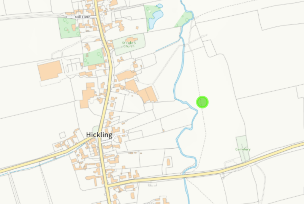

Archaeological Records: Hickling
The Nottinghamshire Historic Environment Record (HER) is the most valuable starting point when exploring existing archaeological records; it includes 88 records in total.
- click here: main records index
- click here: shifted village record
- click here: coin hoard, Hickling Standard
- click here: early medieval/Anglo-Saxon inhumation cemetery
Shifted Village – Hickling (M7581)
SHIFTED VILLAGE? (Med-P Med, Medieval to Post Medieval – 1066 AD to 1779
“There are a variety of earthworks surrounding Hickling including platforms, terraces, banks, hollow ways and ridge and furrow. They would appear to suggest that Hickling has either shrunk or shifted. The earthworks around Long Lane appear to represent a shift in the orientation of the village, as may the earthworks L7586 (1). (2)
See related elements for details of earthworks in specific areas.”
- Parent of: Bank and terrace , Hickling (Element) (L7585)
- Parent of: Banks and ridge and furrow, Hickling (Element) (L7582)
- Parent of: Boundary bank, Hickling (Element) (L7587)
- Parent of: Boundary bank, Hickling (Element) (L7589)
- Parent of: Earthworks at Waterlane Farm, Hickling (Element) (L7588)
- Parent of: Earthworks, east side of Hickling village (Element) (L7586)
- Parent of: Earthworks, Long Lane, Hickling (Element) (L7581)
- Parent of: Earthworks, Manor House, Hickling (Element) (L7590)
- Parent of: Hollow way, Pudding Lane, Hickling (Element) (L7584)
- Parent of: Ridge and furrow, banks and terracing, Hickling (Element) (L7583)
Coin Hoard, Hickling Standard (L5403)
Element record L5403 – Coin Hoard, Hickling Standard, Hickling
“At Hicklin, we are informed by Camden, was a Ro station. It lies at the distance of about 3.5 miles from Willoughby. In May 1771 an urn was ploughed up containing Ro coins. (Info not found in Camden’s Brit.) (1)
Coin hoard found on Standard Hill, 1771. (3)
In 1771 an urn containing nearly 200 denarii was turned up by the plough. Amoung the emperors represented were Vespasian, Domitian, Trajan and Hadrian, also 2 of Faustina and a few coins of Julius Caesar, Augustus and Tiberius, once preserved in a local collection, may have come from the same hoard. (4)
Nothing visible on available APs (OS 68) on or near Hickling Standard. (5)
See L285, L312 for cropmarks.”
- <1> Throsby J, 1790, Thoroton’s History of Notts Vol 1, p 147 (Published document). SNT1345.
- <2> Throsby J, 1790, Thoroton’s History of Notts Vol 2, p 143 (Published document). SNT1346.
- <3> Lewis S, 1845, Topographical Dictionary of England (6th Edn), p 502 (Published document). SNT879.
- <4> VCH, 1910, Notts, p 28 (Published document). SNT1384.
- <5> NC, 1970, Pers Comm (Personal comment). SNT949.
Inhumation Cemetery? (Early Medieval – 410 AD to 1065 AD)
Full Description: A series of stone covered graves revealed by ploughing, were thought to be part of an Anglo-Saxon cemetery by the late Mr MJ Dean. (1)
- EMAB eds, 1974, East Midlands Archaeological Bulletin, p 45 (Published document). SNT161.