Maps are things of beauty, a practical historical record (as well as being a subjective record of the culture and understanding of their time) and a very valuable source; changes can be traced and dates identified whilst handwritten notes often add a further layer of fascination.
(Most of the following maps have come from the Wadkin archives and include Hazel’s annotations.)
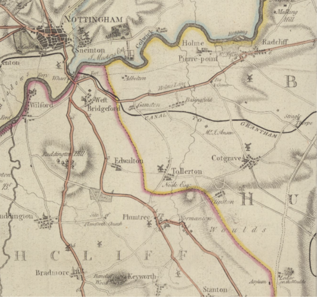
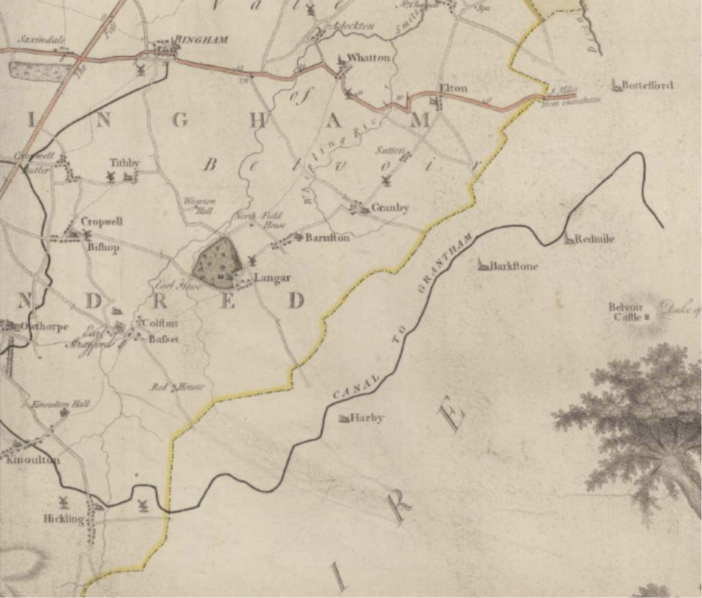
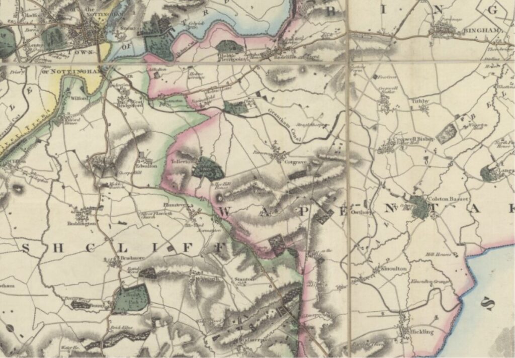
Chapman’s Map of Nottinghamshire – 1794
(National Library of Scotland)
How reliable are maps as source material?
Historians and researchers can generally rely on maps as a valuable source of information; they can be used to date buildings, boundaries and infrastructure as well as recording names used at the time. We often use reliable map makers as a primary source to verify other data or source material.
So when a post popped up on the Grantham Canal Society’s Facebook page asking for a definitive date for the construction of the Grantham Canal there was a general sense of dismay.
John Chapman’s map of Nottinghamshire is dated 1794 – it shows the Grantham Canal in place including a branch line to Bingham which was never constructed. The completion of the Grantham Canal wasn’t formally confirmed by Act of Parliament until 1797.
The source of the mapping detail used by John Chapman is easily identified; his map transcribes the plans created in 1792 and published with the proposal submitted to (and passed by) Parliament in 1793. To show the canal as constructed in 1794 was somewhat premature as well as proving to be inaccurate, too.
A later map of Nottinghamshire produced by Greenwood in 1826 is annotated: ‘Map of the county of Nottingham from an actual survey made in the years 1824 & 1825’ – more accurate and not including the Bingham branchline.
The Chapman map offers an interesting insight into the work of mapmakers and how they collated the information recorded on their maps; it also acts as a reminder that historic data does need checking and double-checking …
Chapman's Map of Notts 1774 (inc. Mills) & canal superimposed
Chapman's Map of Notts 1774 (inc. Mills) & canal superimposed
Chapman's Map of Notts 1774 (inc. Mills) & canal superimposed
Chapman's Map of Notts 1774 (inc. Mills) & canal superimposed
Chapman's Map of Notts 1774 (inc. Mills) & canal superimposed
Chapman's Map of Notts 1774 (inc. Mills) & canal superimposed
Chapman's Map of Notts 1774 (inc. Mills) & canal superimposed
Chapman's Map of Notts 1774 (inc. Mills) & canal superimposed
Chapman's Map of Notts 1774 (inc. Mills) & canal superimposed
Chapman's Map of Notts 1774 (inc. Mills) & canal superimposed
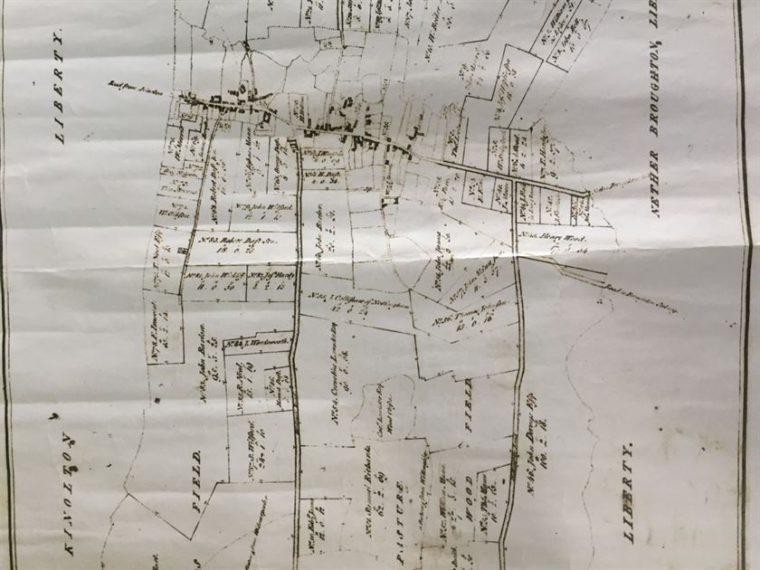
Fields Map (pre-Enclosure?)
Fields Map (pre-Enclosure?)
Fields Map (pre-Enclosure?)
Fields Map (pre-Enclosure?)
Fields Map (pre-Enclosure?)
Fields Map (pre-Enclosure?)
Fields Map (pre-Enclosure?)
Fields Map (pre-Enclosure?)
Fields Map (pre-Enclosure?)
Fields Map (pre-Enclosure?)
Fields Map (pre-Enclosure?)
Fields Map (pre-Enclosure?)
Fields Map (pre-Enclosure?)
Fields Map (pre-Enclosure?)
Fields Map (pre-Enclosure?)
Fields Map (pre-Enclosure?)
Fields Map (pre-Enclosure?)
Fields Map (pre-Enclosure?)
Fields Map (pre-Enclosure?)
Fields Map (pre-Enclosure?)
Fields Map (pre-Enclosure?)
Fields Map (pre-Enclosure?)
Fields Map (pre-Enclosure?)
Fields Map (pre-Enclosure?)
Fields Map (pre-Enclosure?)
Fields Map (pre-Enclosure?)
Fields Map (pre-Enclosure?)
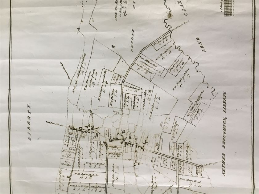
Enclosure Map 1774
Older Enclosures are shown with dotted lines. Note is also made of the accompanying book (available in the Notts Archives) which gives full details for each parcel of land.
Enclosure Map 1774
Enclosure Map 1774
Enclosure Map 1774
Enclosure Map 1774
Enclosure Map 1774
Enclosure Map 1774
Enclosure Map 1774
Enclosure Map 1774
Enclosure Map 1774
Enclosure Map 1774
Enclosure Map 1774
Enclosure Map 1774
Enclosure Map 1777
Enclosure Map 1777
Enclosure Map 1777
Enclosure Map 1777
Enclosure Map 1777
Enclosure Map 1777
Enclosure Map 1777
Enclosure Map 1777
Enclosure Map 1777
Enclosure Map 1777
Enclosure Map 1777
Enclosure Map 1777
Enclosure Map 1777
Enclosure Map 1777
Enclosure Map 1777
Enclosure Map 1777
Enclosure Map 1777
Enclosure Map 1777
Enclosure Map 1777
Enclosure Map 1777
Enclosure Map 1777
Enclosure Map 1777
Enclosure Map 1777
Enclosure Map 1777
Enclosure Map 1777
Enclosure Map 1777
Enclosure Map 1777
Enclosure Map 1777
Enclosure Map 1777
Enclosure Map 1777
Enclosure Map 1777
Enclosure Map 1777
Enclosure Map 1777
Enclosure Map 1777
Enclosure Map 1777
Enclosure Map 1777
Enclosure Map 1777
Enclosure Map 1777
Enclosure Map 1777
Enclosure Map 1777
Enclosure Map 1777
Enclosure Map 1777
Enclosure Map 1777
Enclosure Map 1777
Enclosure Map 1777
Enclosure Map 1777
Enclosure Map 1777
Enclosure Map 1777
Enclosure Map 1777
Enclosure Map 1777
Enclosure Map 1777
Enclosure Map 1777
Enclosure Map 1777
Enclosure Map 1777
Enclosure Map 1777 (R Meakin, Church View Cottage)
Enclosure Map 1777 (R Meakin, Church View Cottage)
Enclosure Map 1777 (R Meakin, Church View Cottage)
Enclosure Map 1777 (R Meakin, Church View Cottage)
Enclosure Map 1777 (R Meakin, Church View Cottage)
Enclosure Map 1777 (R Meakin, Church View Cottage)
Enclosure Map 1777 (R Meakin, Church View Cottage)
Enclosure Map 1777 (R Meakin, Church View Cottage)
Enclosure Map 1777 (R Meakin, Church View Cottage)
Enclosure Map 1777 (R Meakin, Church View Cottage)
Enclosure Map 1777 (R Meakin, Church View Cottage)
Enclosure Map 1777 (R Meakin, Church View Cottage)
Enclosure Map 1777 (R Meakin, Church View Cottage)
Enclosure Map 1777 (R Meakin, Church View Cottage)
Enclosure Map 1777
Enclosure Map 1777
Enclosure Map 1777
Enclosure Map 1777
Enclosure Map 1777
Enclosure Map 1777
Enclosure Map 1777
Enclosure Map 1777
Enclosure Map 1777
Enclosure Map 1777
Enclosure Map 1777
Enclosure Map 1777
Enclosure Map 1777
Enclosure Map 1777
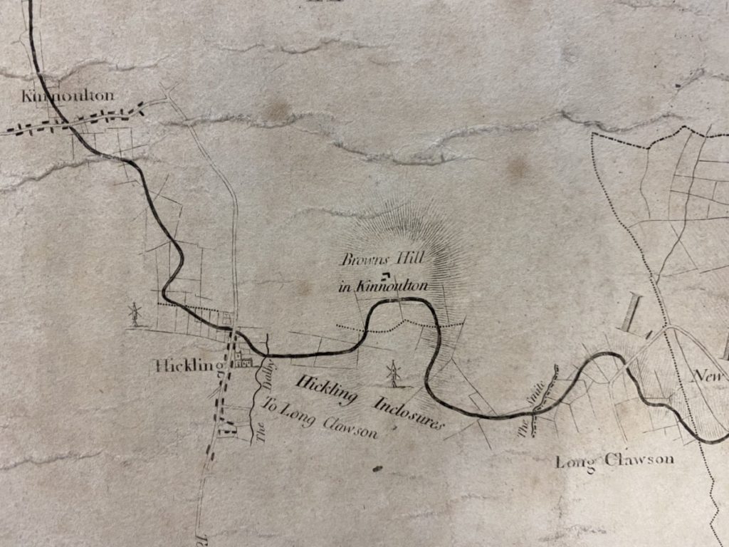
Upper Broughton (Enclosure Map?)
Upper Broughton (Enclosure Map?)
Upper Broughton (Enclosure Map?)
Upper Broughton (Enclosure Map?)
Upper Broughton (Enclosure Map?)
Upper Broughton (Enclosure Map?)
Upper Broughton (Enclosure Map?)
Upper Broughton (Enclosure Map?)
Upper Broughton (Enclosure Map?)
Upper Broughton (Enclosure Map?)
Upper Broughton (Enclosure Map?)
Upper Broughton (Enclosure Map?)
Upper Broughton (Enclosure Map?)
Upper Broughton (Enclosure Map?)
Upper Broughton (Enclosure Map?)
Upper Broughton (Enclosure Map?)
Upper Broughton (Enclosure Map?)
Upper Broughton (Enclosure Map?)
Upper Broughton (Enclosure Map?)
Upper Broughton (Enclosure Map?)
Upper Broughton (Enclosure Map?)
Upper Broughton (Enclosure Map?)
Upper Broughton (Enclosure Map?)
Upper Broughton (Enclosure Map?)
Upper Broughton (Enclosure Map?)
Upper Broughton (Enclosure Map?)
Upper Broughton (Enclosure Map?)
Upper Broughton (Enclosure Map?)
Upper Broughton (Enclosure Map?)
Upper Broughton (Enclosure Map?)
Upper Broughton (Enclosure Map?)
Upper Broughton (Enclosure Map?)
Upper Broughton (Enclosure Map?)
Land parcels map (based on Enclosure Map 1777 but including the railway & canal) – mid-1800s?
Land parcels map (based on Enclosure Map 1777 but including the railway & canal) - mid-1800s?
Land parcels map (based on Enclosure Map 1777 but including the railway & canal) - mid-1800s?
Land parcels map (based on Enclosure Map 1777 but including the railway & canal) - mid-1800s?
Land parcels map (based on Enclosure Map 1777 but including the railway & canal) - mid-1800s?
Land parcels map (based on Enclosure Map 1777 but including the railway & canal) - mid-1800s?
Land parcels map (based on Enclosure Map 1777 but including the railway & canal) - mid-1800s?
Land parcels map (based on Enclosure Map 1777 but including the railway & canal) - mid-1800s?
Land parcels map (based on Enclosure Map 1777 but including the railway & canal) - mid-1800s?
Land parcels map (based on Enclosure Map 1777 but including the railway & canal) - mid-1800s?
Land parcels map (based on Enclosure Map 1777 but including the railway & canal) - mid-1800s?
Land parcels map (based on Enclosure Map 1777 but including the railway & canal) - mid-1800s?
Land parcels map (based on Enclosure Map 1777 but including the railway & canal) - mid-1800s?
Land parcels map (based on Enclosure Map 1777 but including the railway & canal) - mid-1800s?
Land parcels map (based on Enclosure Map 1777 but including the railway & canal) - mid-1800s?
Land parcels map (based on Enclosure Map 1777 but including the railway & canal) - mid-1800s?
Land parcels map (based on Enclosure Map 1777 but including the railway & canal) - mid-1800s?
Land parcels map (based on Enclosure Map 1777 but including the railway & canal) - mid-1800s?
Land parcels map (based on Enclosure Map 1777 but including the railway & canal) - mid-1800s?
Land parcels map (based on Enclosure Map 1777 but including the railway & canal) - mid-1800s?
Land parcels map (based on Enclosure Map 1777 but including the railway & canal) - mid-1800s?
Land parcels map (based on Enclosure Map 1777 but including the railway & canal) - mid-1800s?
Land parcels map (based on Enclosure Map 1777 but including the railway & canal) - mid-1800s?
Land parcels map (based on Enclosure Map 1777 but including the railway & canal) - mid-1800s?
Land parcels map (based on Enclosure Map 1777 but including the railway & canal) - mid-1800s?
Land parcels map (based on Enclosure Map 1777 but including the railway & canal) - mid-1800s?
Land parcels map (based on Enclosure Map 1777 but including the railway & canal) - mid-1800s?
Land parcels map (based on Enclosure Map 1777 but including the railway & canal) - mid-1800s?
Land parcels map (based on Enclosure Map 1777 but including the railway & canal) - mid-1800s?
Land parcels map (based on Enclosure Map 1777 but including the railway & canal) - mid-1800s?
Land parcels map (based on Enclosure Map 1777 but including the railway & canal) - mid-1800s?
Land parcels map (based on Enclosure Map 1777 but including the railway & canal) - mid-1800s?
Land parcels map (based on Enclosure Map 1777 but including the railway & canal) - mid-1800s?
Land parcels map (based on Enclosure Map 1777 but including the railway & canal) - mid-1800s?
Land parcels map (based on Enclosure Map 1777 but including the railway & canal) - mid-1800s?
Land parcels map (based on Enclosure Map 1777 but including the railway & canal) - mid-1800s?
Land parcels map (based on Enclosure Map 1777 but including the railway & canal) - mid-1800s?
Land parcels map (based on Enclosure Map 1777 but including the railway & canal) - mid-1800s?
Land parcels map (based on Enclosure Map 1777 but including the railway & canal) - mid-1800s?
Land parcels map (based on Enclosure Map 1777 but including the railway & canal) - mid-1800s?
Land parcels map (based on Enclosure Map 1777 but including the railway & canal) - mid-1800s?
Land parcels map (based on Enclosure Map 1777 but including the railway & canal) - mid-1800s?
Land parcels map (based on Enclosure Map 1777 but including the railway & canal) - mid-1800s?
Land parcels map (based on Enclosure Map 1777 but including the railway & canal) - mid-1800s?
Land parcels map (based on Enclosure Map 1777 but including the railway & canal) - mid-1800s?
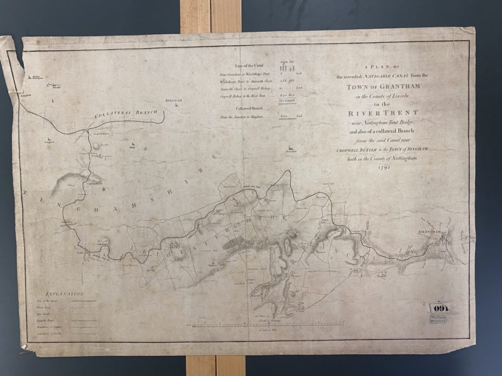
1792: Plan accompanying the Act of Parliament for the construction of the Grantham Canal:
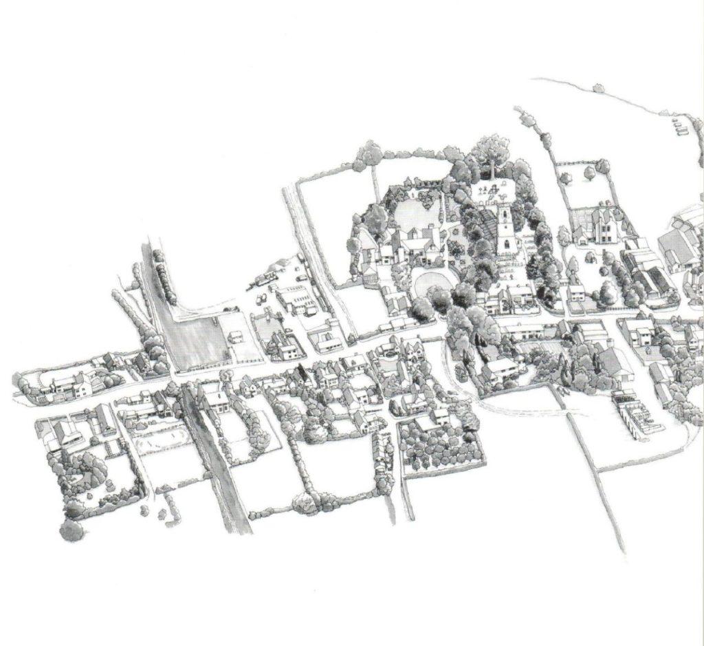
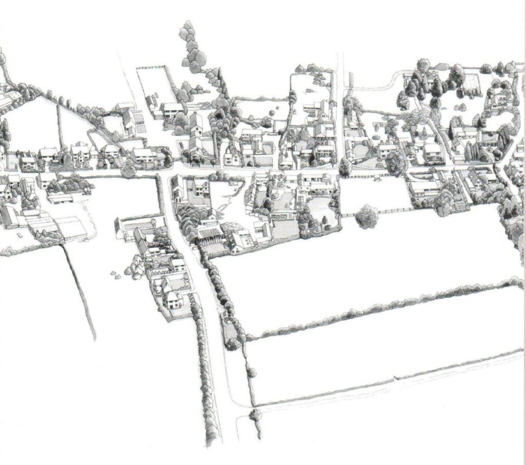
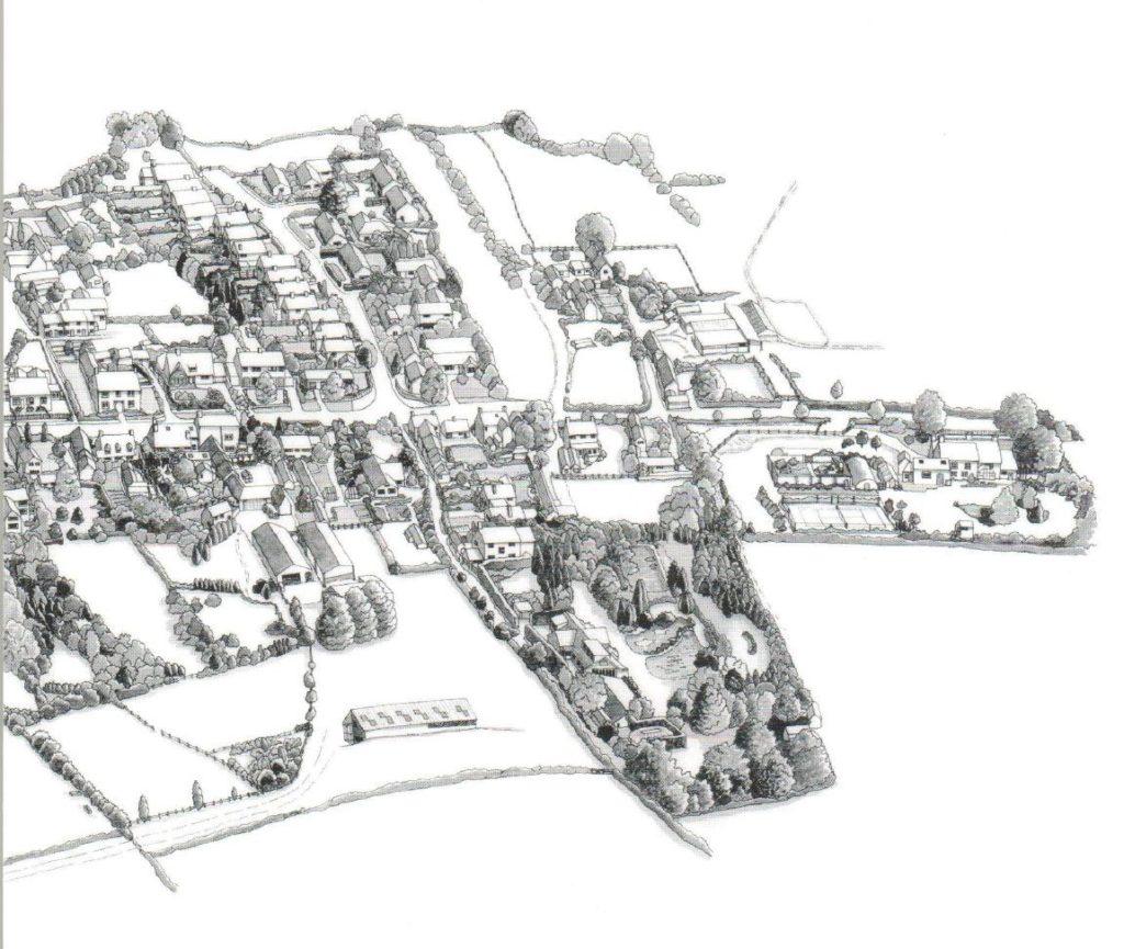
1868: Parish Map – a (very) large map of the village from 1868 was given to the village in 2016 by Keith Wadkin and framed with the support of our Borough Councillor, T. Combellack. It is on display in the Village Hall.
1884 OS map – + labelled in 1976
1884 OS map - labelled in 1976
1884 OS map - labelled in 1976
1884 OS map - labelled in 1976
1884 OS map - labelled in 1976
1884 OS map - labelled in 1976
1884 OS map - labelled in 1976
1884 OS map - labelled in 1976
1884 OS map - labelled in 1976
1884 OS map - labelled in 1976
1884 OS map - labelled in 1976
1884 OS map - labelled in 1976
1884 OS map - labelled in 1976
1884 OS map - labelled in 1976
1884 OS map - labelled in 1976
1884 OS map - labelled in 1976
1884 OS map - labelled in 1976
1884 OS map - labelled in 1976
1884 OS map - labelled in 1976
1884 OS map - labelled in 1976
1884 OS map - labelled in 1976
1884 OS map - labelled in 1976
1884 OS map - labelled in 1976
1884 OS map - labelled in 1976
1884 OS map - labelled in 1976
1884 OS map - labelled in 1976
1884 OS map - labelled in 1976
1884 OS map - labelled in 1976
1884 OS map - labelled in 1976
1884 OS map - labelled in 1976
1884 OS map - labelled in 1976
1884 OS map - labelled in 1976
1884 OS map - labelled in 1976
1884 OS map - labelled in 1976
1884 OS map - labelled in 1976
OS 1884 (copied and labels added 1976)
OS 1884 (copied and labels added 1976)
OS 1884 (copied and labels added 1976)
OS 1884 (copied and labels added 1976)
OS 1884 (copied and labels added 1976)
OS 1884 (copied and labels added 1976)
OS 1884 (copied and labels added 1976)
OS 1884 (copied and labels added 1976)
OS 1884 (copied and labels added 1976)
OS 1884 (copied and labels added 1976)
OS 1884 (copied and labels added 1976)
OS 1884 (copied and labels added 1976)
OS 1884 (copied and labels added 1976)
OS 1884 (copied and labels added 1976)
OS 1884 (copied and labels added 1976)
OS 1884 (copied and labels added 1976)
OS 1884 (copied and labels added 1976)
OS 1884 (copied and labels added 1976)
OS 1884 (copied and labels added 1976)
OS 1884 (copied and labels added 1976)
OS 1884 (copied and labels added 1976)
OS 1884 (copied and labels added 1976)
OS 1884 (copied and labels added 1976)
OS 1884 (copied and labels added 1976)
OSmap 1884 1in2500 1
OSmap 1884 1in2500 1
OSmap 1884 1in2500 2
OSmap 1884 1in2500 2
OSmap 1884 1in2500 3
OSmap 1884 1in2500 3
OSmap 1884 1in2500 4
OSmap 1884 1in2500 4
OSmap 1884 1in2500 5
OSmap 1884 1in2500 5
OSmap 1884 1in2500 6
OSmap 1884 1in2500 6
OSmap 1884 1in2500 7
OSmap 1884 1in2500 7
OSmap 1884 1in2500 8
OSmap 1884 1in2500 8
Hickling street plan (south of the Church) – 1900s?
(dating based on reference to the Chapel Sunday School)
Hickling streetplan (south of the Church) - 1900s?
Hickling streetplan (south of the Church) - 1900s?
Hickling streetplan (south of the Church) - 1900s?
Hickling streetplan (south of the Church) - 1900s?
Hickling streetplan (south of the Church) - 1900s?
Hickling streetplan (south of the Church) - 1900s?
Hickling streetplan (south of the Church) - 1900s?
Hickling streetplan (south of the Church) - 1900s?
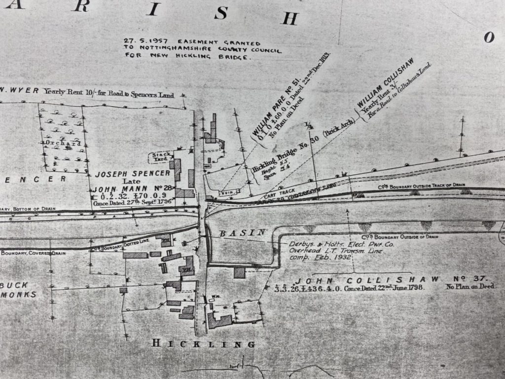
Largescale OS map (1970s); including land sale annotations
large scale OS map (1970s) marked to show land sales
large scale OS map (1970s) marked to show land sales
large scale OS map (1970s) marked to show land sales
large scale OS map (1970s) marked to show land sales
large scale OS map (1970s) marked to show land sales
large scale OS map (1970s) marked to show land sales
large scale OS map (1970s) marked to show land sales
large scale OS map (1970s) marked to show land sales
Largescale OS map (1970s)
largescale OS map (1970s) - unmarked
largescale OS map (1970s) - unmarked
largescale OS map (1970s) - unmarked
largescale OS map (1970s) - unmarked
largescale OS map (1970s) - unmarked
largescale OS map (1970s) - unmarked
largescale OS map (1970s) - unmarked
largescale OS map (1970s) - unmarked
largescale OS map (1970s) - unmarked
largescale OS map (1970s) - unmarked
Plan of fields of Hickling (late 1970s?)
Map is after 1964 when the Widmerpool/A46/A606 roundabout was built and after Harles Acres was developed but before the development of Marsh’s Paddock.
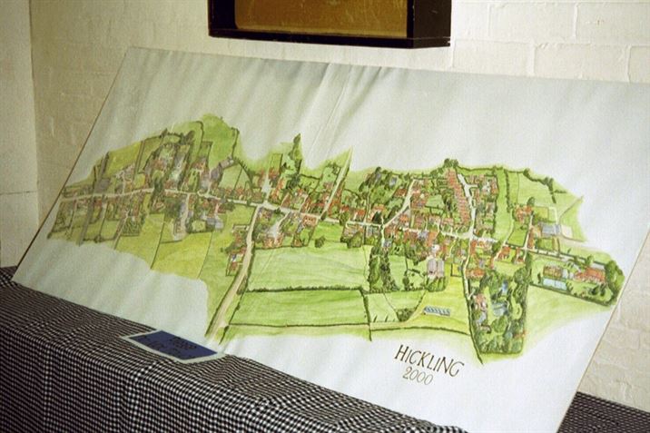
To commemorate the turn of the Millennium, the village produced a Domesday Book which included a beautifully drawn map of Hickling as it was in the year 2000. The artist is Mrs Barbara McEwen; the original full sized colour painting is on display in the Village Hall whilst smaller framed colour versions were sold and can be found in many homes in Hickling. A pen and ink version was included as the centrepiece of the book.
 & canal superimposed")
 & canal superimposed")
 & canal superimposed")
 & canal superimposed")
 & canal superimposed")
")
")
")
")
")
")
")
")
")
")
")
")
")


")
")
")
")
")
")
")


")
")
")
")
")
")
")
")
")
")
")
")
")
")
")
")
 - mid-1800s?")
 - mid-1800s?")
 - mid-1800s?")
 - mid-1800s?")
 - mid-1800s?")
 - mid-1800s?")
 - mid-1800s?")
 - mid-1800s?")
 - mid-1800s?")
 - mid-1800s?")
 - mid-1800s?")
 - mid-1800s?")
 - mid-1800s?")
 - mid-1800s?")
 - mid-1800s?")
 - mid-1800s?")
 - mid-1800s?")
 - mid-1800s?")
 - mid-1800s?")
 - mid-1800s?")
 - mid-1800s?")
 - mid-1800s?")


")
")
")
")
")
")
")
")
")
")
")
")


 - 1900s?")
 - 1900s?")
 - 1900s?")
 - 1900s?")


")
")
")
")
")
")
")
")
")
")
")
")
")
")
")
")


")
")
")
")
")
")
")
 marked to show land sales")
 marked to show land sales")
 marked to show land sales")
 marked to show land sales")
 - unmarked")
 - unmarked")
 - unmarked")
 - unmarked")
 - unmarked")
")
")
")
")
")
")
")
")
")
")
")
")


")
")
")
")
")
")
")