On this page:
- Historic England: RAF/Ordnance Survey – aerial photographs (1947)
- St. Luke’s Hickling (Mitchell Kinvig, 2024)
- Triptych of Aerial Photographs of Hickling
- Hickling 1997/8
- Home Farm/Beech House
- Rosegarth and Fern Bank, Main Street (1981)
- Clawson Lane Junction c.1960s
- The Olde Barn, Main Street
- From the Wadkin Archives
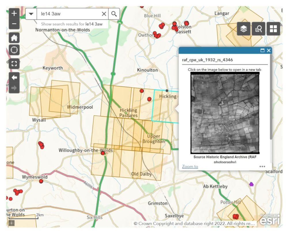
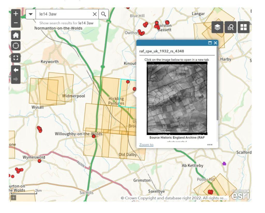
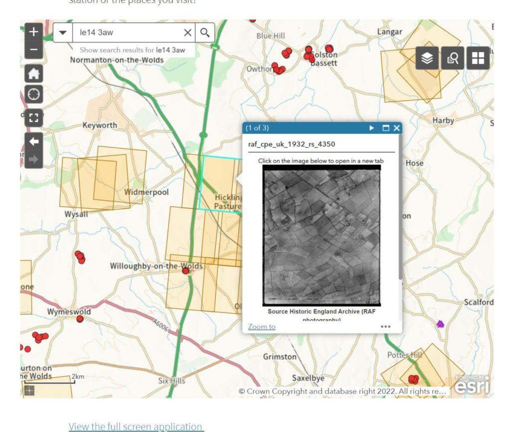
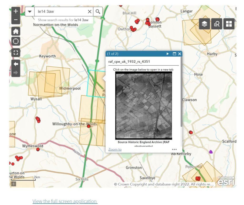
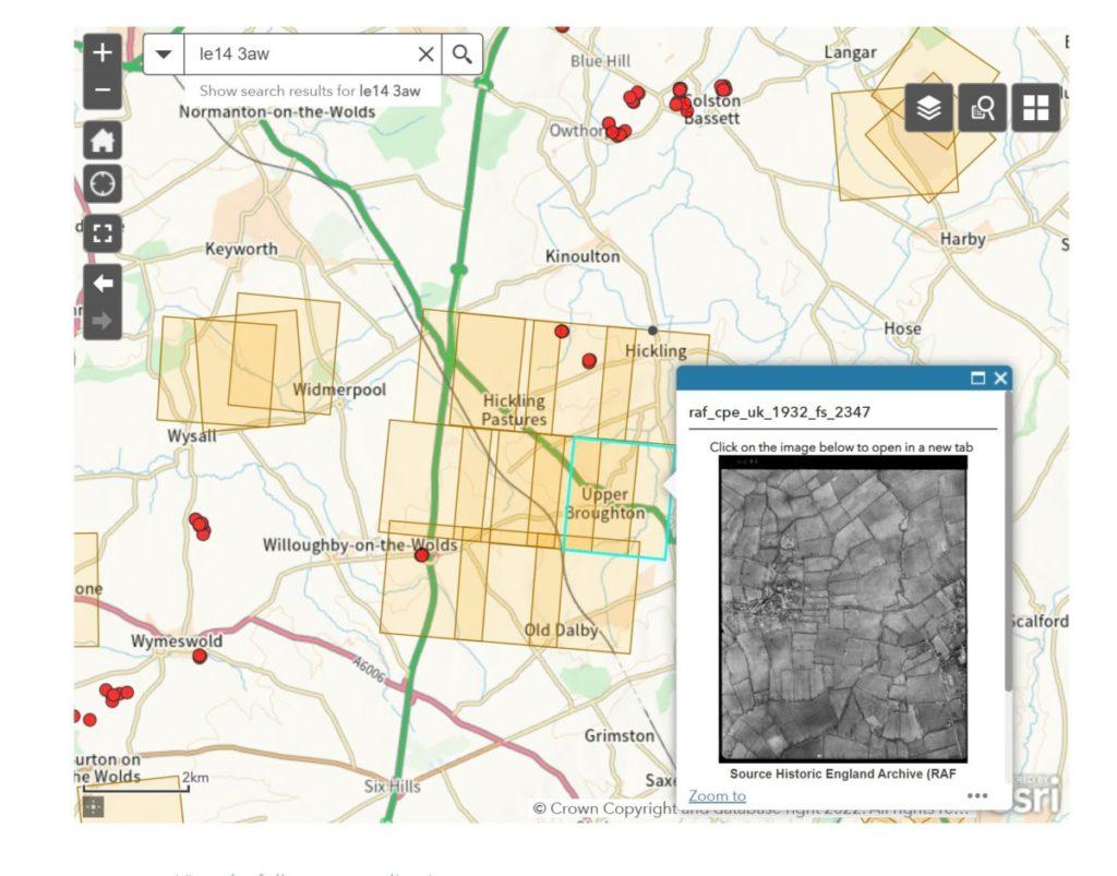
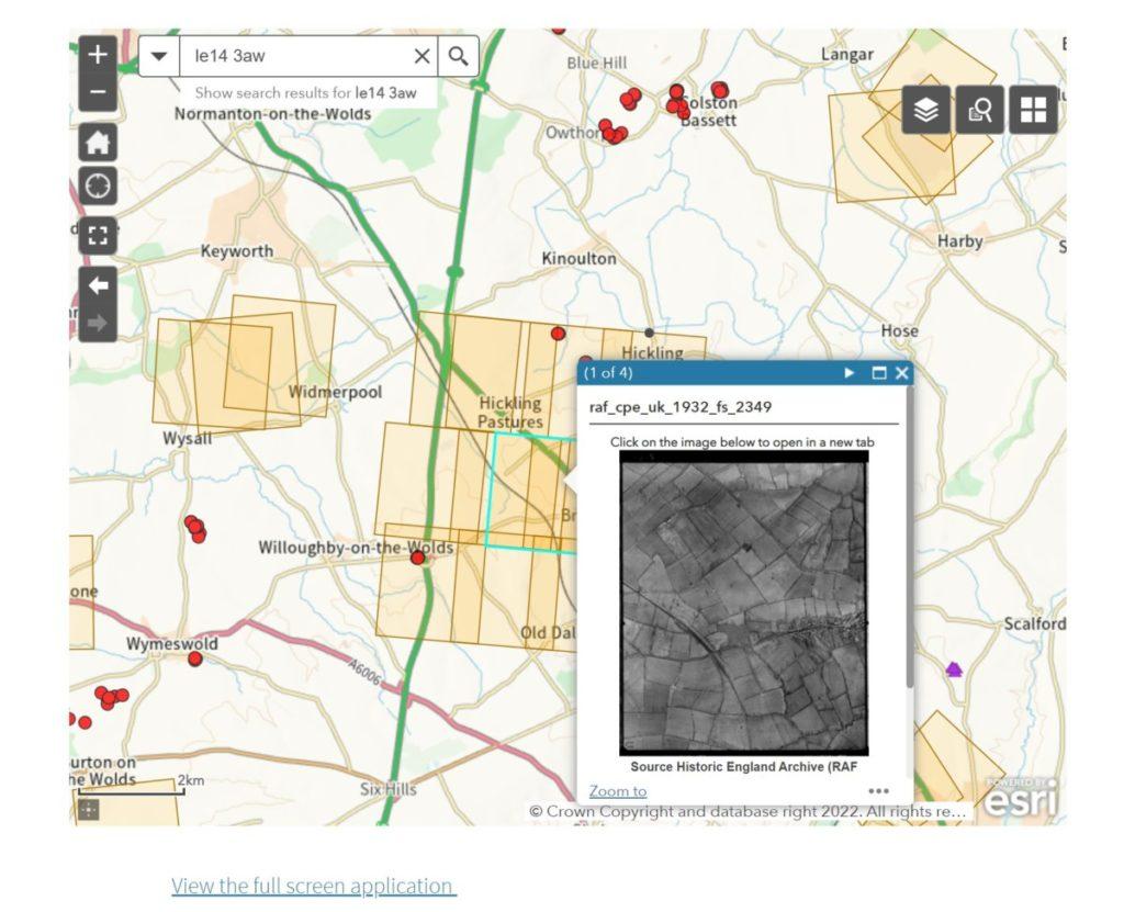
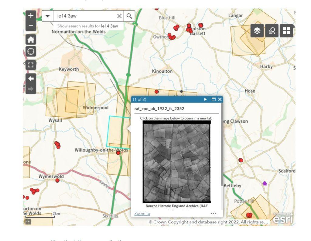
Historic England: RAF/Ordnance Survey – aerial photographs (1947)
- Search by postcode/location
- Yellow squares indicate when an aerial photograph is available
- Click on each one for a link to the photograph
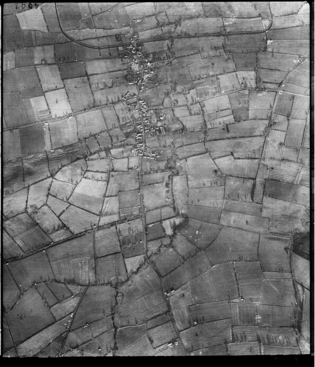
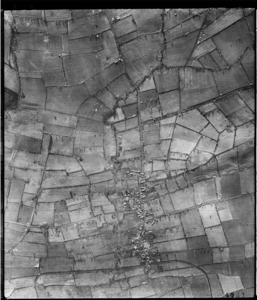
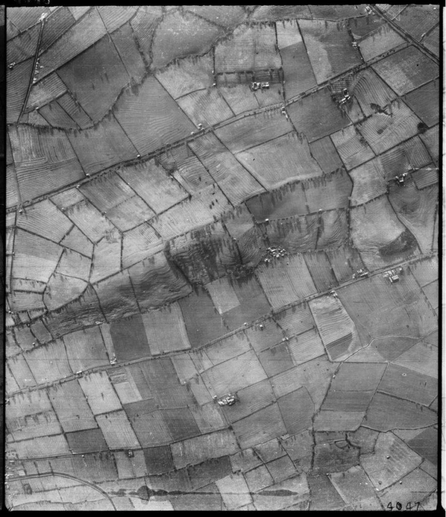
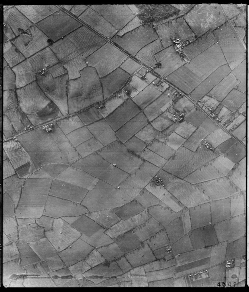
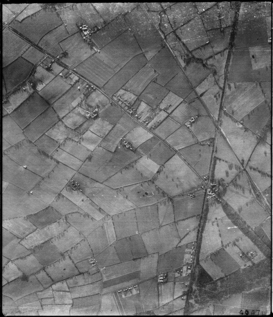
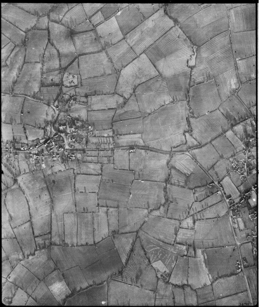
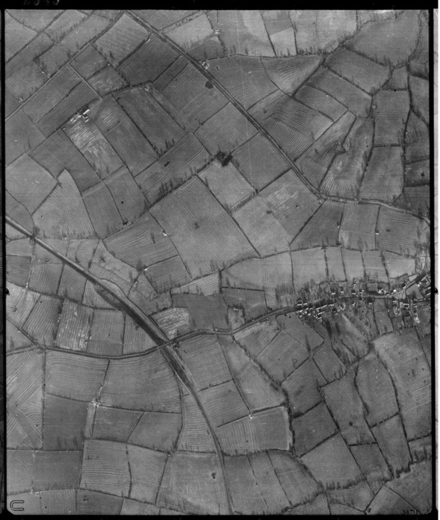
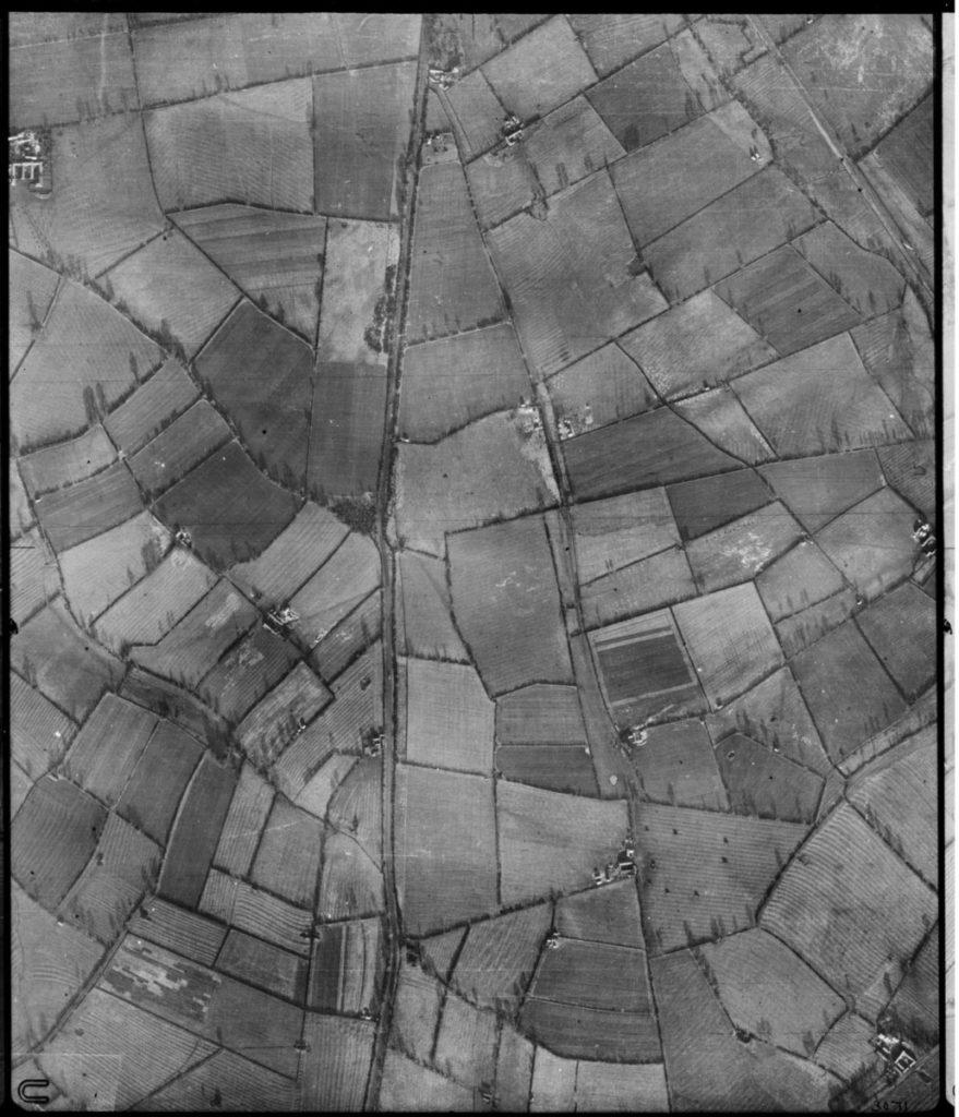
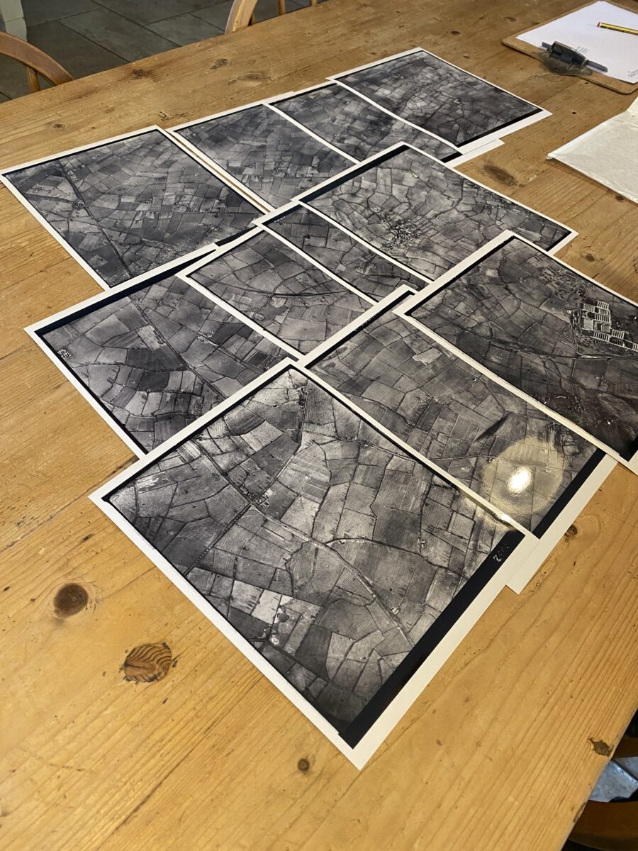
The photographs that are available in this collection for Hickling date from 1947. It seems that there are several series of photographs for our area but these are the only Winter images – without leaves on the trees much more is visible.
We do have good quality scans of these images available to view but some highlights include:
- The ridge and furrow field patterns.
- The tree shadows are clearly visible; they seem to indicate the photographs were taken at about 10 o’clock in the morning.
- Long Lane is visible moving west from the southern end of Hickling village. Long Lane is an ancient route which originally extended along the top of the Standard, along the line of Folly Hall Lane towards Willoughby and the Roman settlement of Vernometum. The shades of this route and of the Roman settlement (in the fields close to the Willoughby Hotel on the A46) can still be seen on these photographs.
- The A46 can be seen in its relatively insignificant 1940s form.
- Odd black blotches are clouds between the plane and the ground.
University of Cambridge: Britain from the air – 1945-2009
“For decades, former RAF pilots – some decorated war heroes – took to the skies of Britain at the instruction of legendary Cambridge archaeologist JK St Joseph in a unique project to map the changing face of the UK via the university’s remarkable Committee for Aerial Photography. The photographs, covering almost every corner of the UK, bring back to life a disappeared Britain and capture the loss of our industrial heritage, the destruction of ridge and furrow landscapes unchanged for centuries, and the emergence of motorways, skyscrapers and modern cityscapes. The earliest photographs, numbering in the hundreds, date back to 1945 – but the project took off in earnest in 1947 when, over the course of the year, more than 2,000 aerial images were captured. The Committee continued to borrow RAF planes and pilots until the University bought its own Cessna Skymaster in 1965.”
The best way to view these images digitally is to click on the link to Historic England and to zoom in on the original images. Alternatively, you can click on the images above and use the zoom function on your computer but the picture quality isn’t as sharp.
However, the best way to view them is using a Sterioscope.
The photographs were deliberately taken with an overlap. The Sterioscope uses mirrors to bring overlapping images together and appear in 3-D.
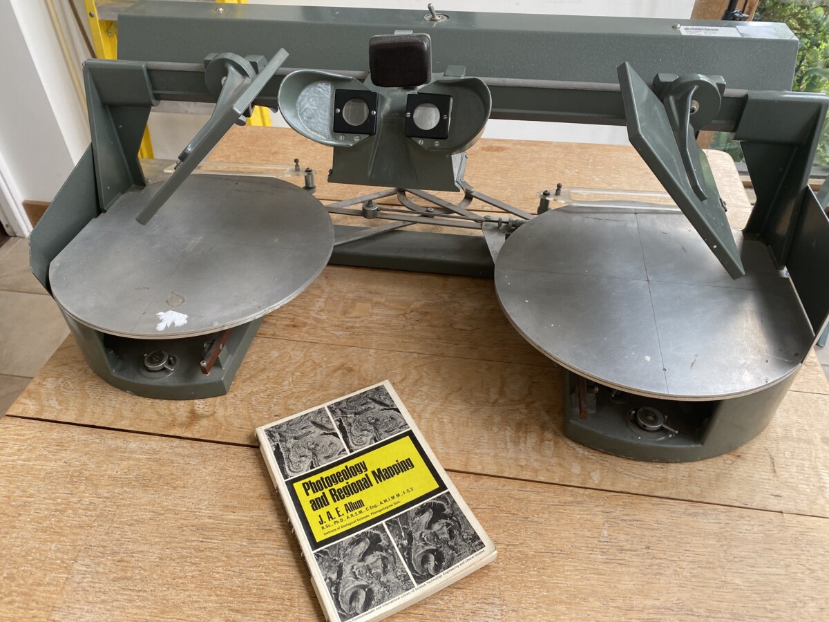
A gentleman locally has a working sterioscope and copies of the Upper Broughton and Hickling photographs. These will be demonstrated at The Plough on July 25th 2023 but outside this time, please contact us.
St. Luke’s, Hickling – drone images (Mitchell Kinvig, 2024)
")
")
")
")
")
")
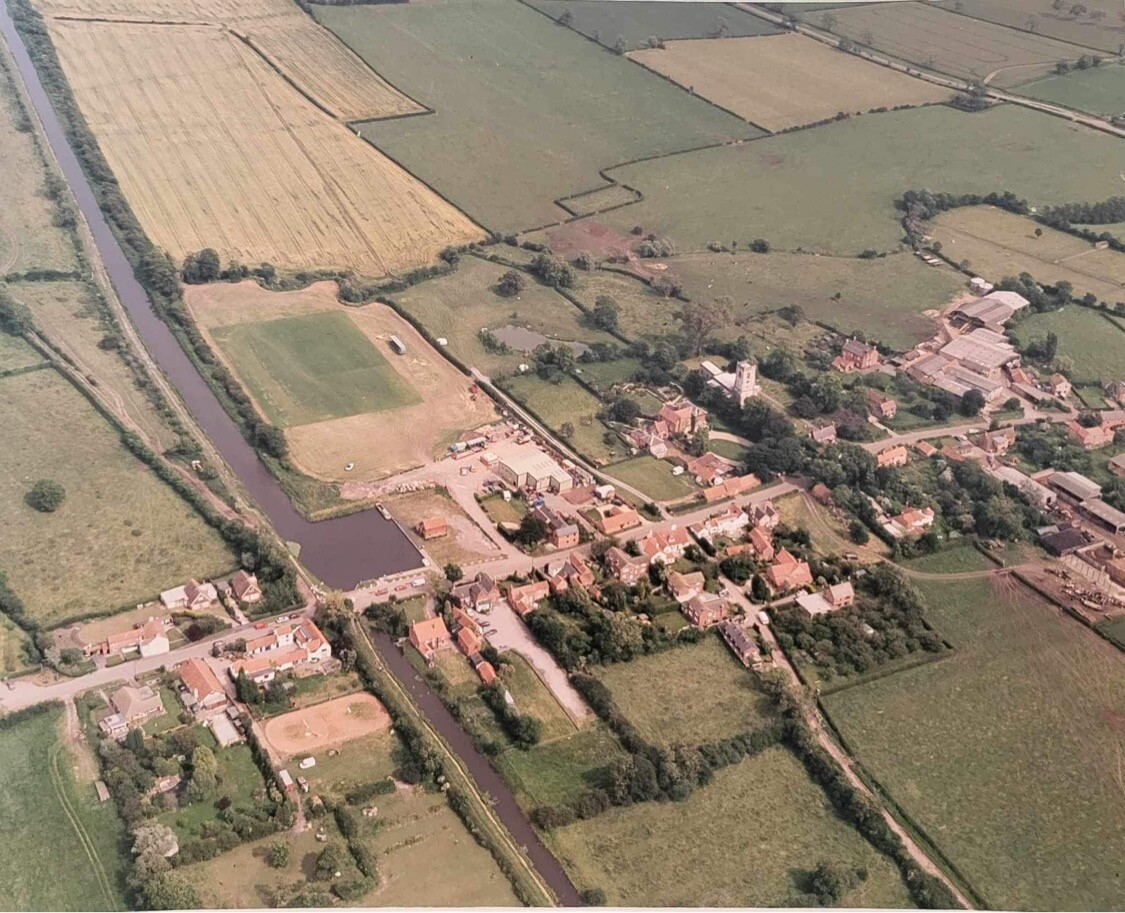
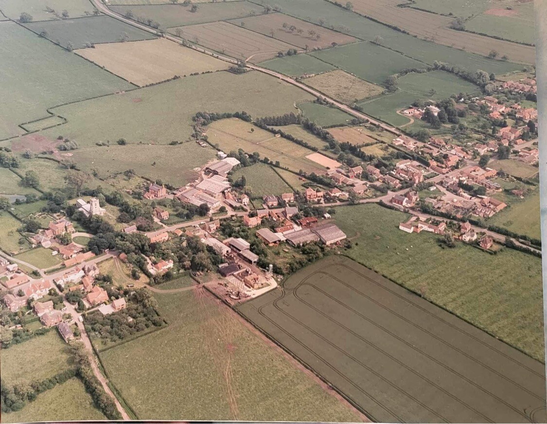
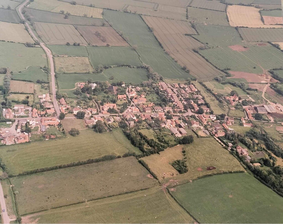
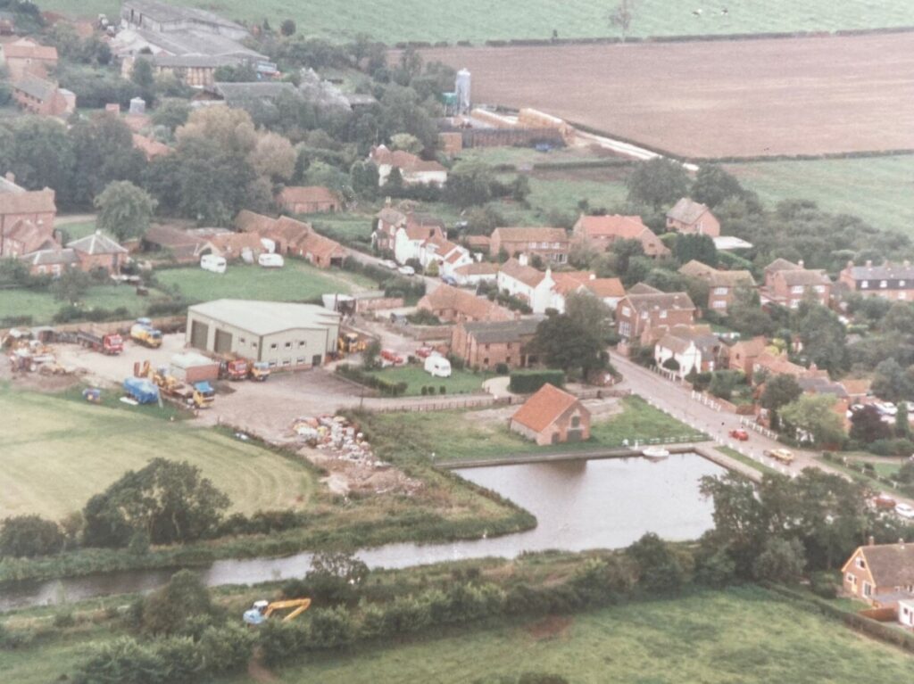
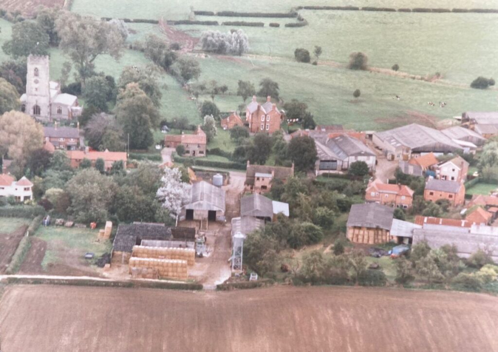
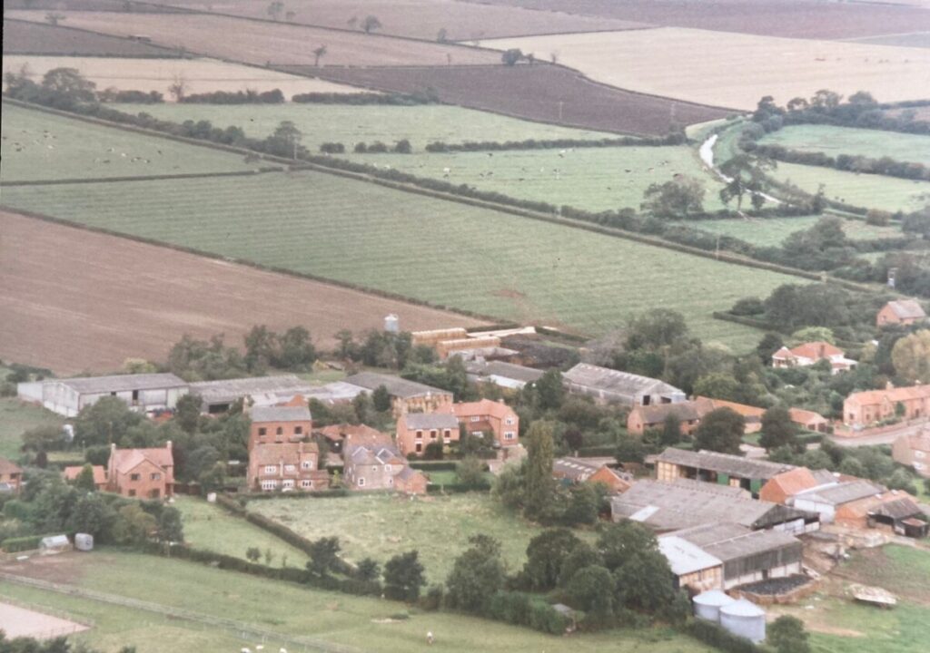
Series of Three Hickling Aerial Photographs
(Norton family)
We think we have roughly dated these aerial photographs; however, please contact us if you can help.
Our best guess is sometime between 1996 and late May 2001; the new offices at Faulks’ were built in 1996 and they look quite new here. Similarly, the football pitch and the new silage clamp at Church Farm may help with dating. One aspect which suggests a date late in this range is the gravelled towpath. Photographs in mid-1999 show the towpath east of Main Street is gravelled but the towpath towards Kinoulton is still grassed. The parched ground and full trees may put them in the late summer and changes on Mill Lane make them unlikely to be later than late May 2001.
It can be fascinating picking out clues in photographs and maps – if you spot anything which can pin the date further, please contact us.
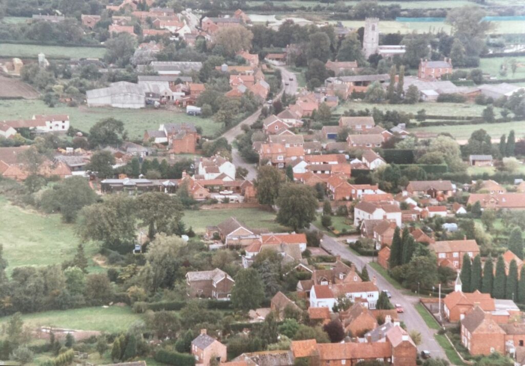
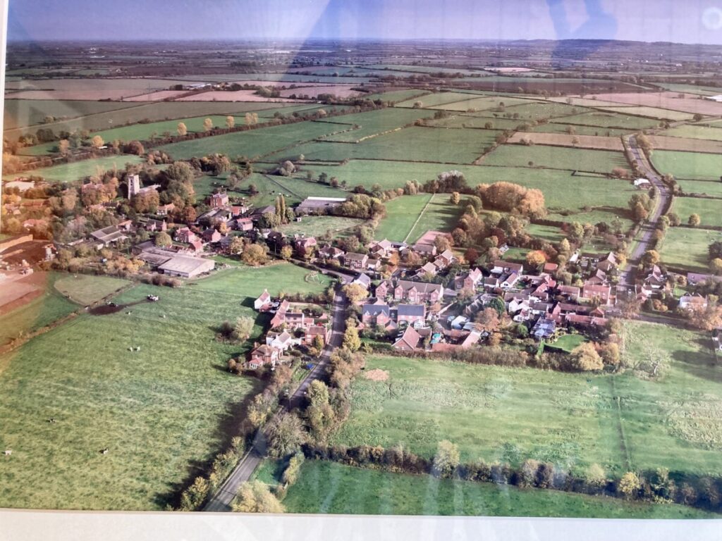
Hickling: 1997/8
Many thanks to Scott & Cathy Hetherington for these aerial photographs of Hickling; dated 1997/8 Scott took these whilst on a helicopter flight over the village.
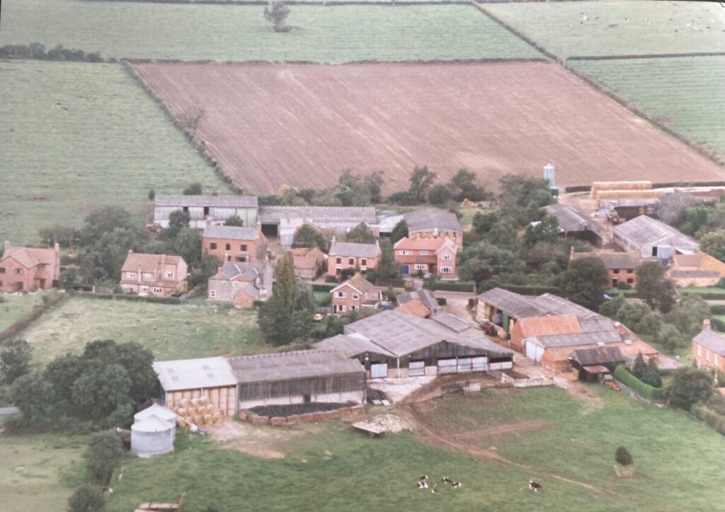
Home Farm/Beech House
(undated/Norton family) Home Farm is in the centre of the image with Beech House nextdoor. To the right of the image is the old School House and part of the Chapel.
Rosegarth and Fern Bank, Main Street (1981)
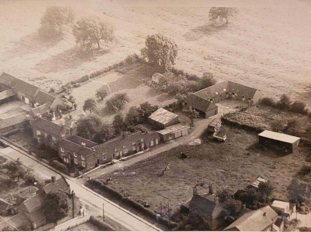
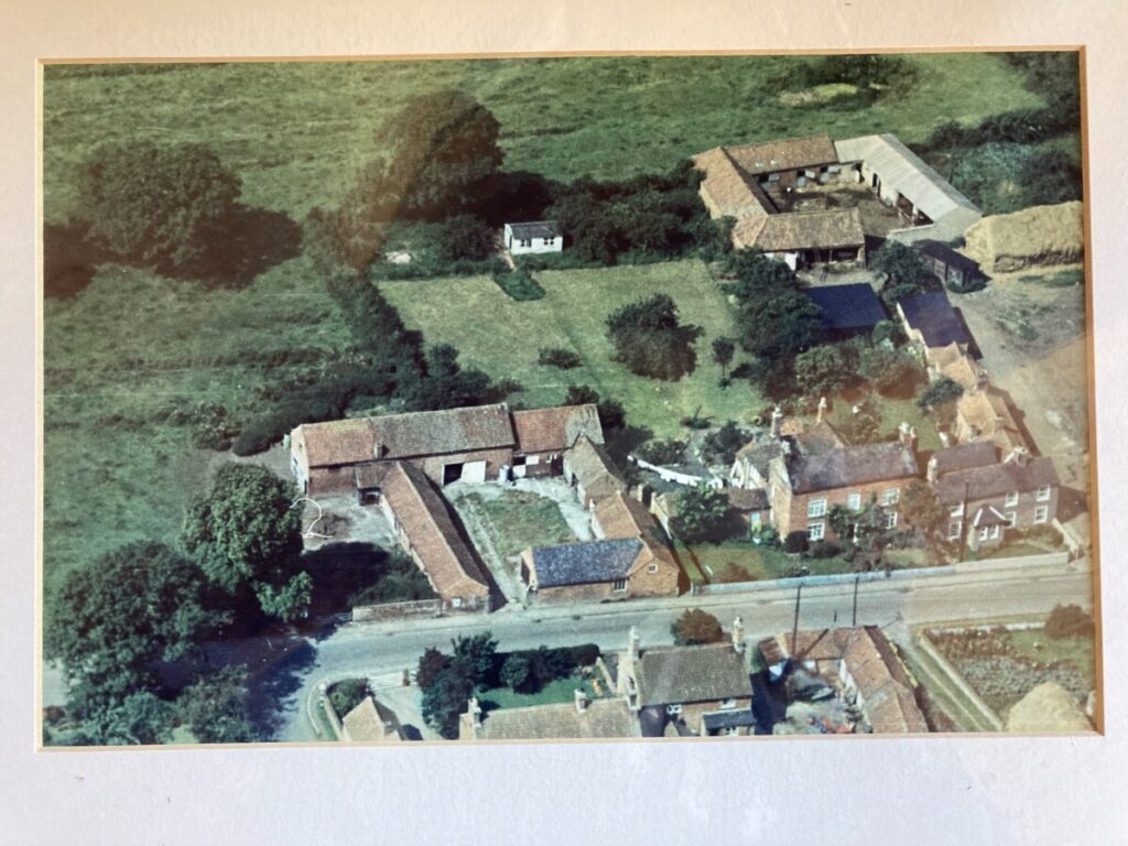
Clawson Lane Junction c.1960s:
Photograph courtesy of M Sharpe and C Marler)

Unfortunately, the photo is undated, but it contains a car that looks like it could be a 1950s Wolseley, so the photo could be from the early/mid 1960s; it is likely to be a very early example of this kind of photograph.
The photo shows (clockwise from top right):
- The west end of Longridge
- The land where Fairholme is now built
- What was The Cottage and The Little Cottage (now just The Cottage)
- March’s Farm
- The farm buildings that are now Richmond Cottage
Opposite the latter three are:
- The buildings that are now The Olde Barn
- Beech House
Finally, to the top left of the photo are the farm buildings that are now:
- The Byre
- The Barn
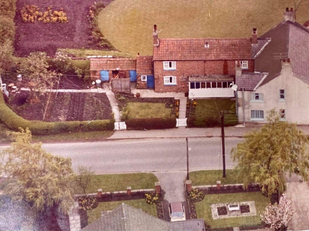
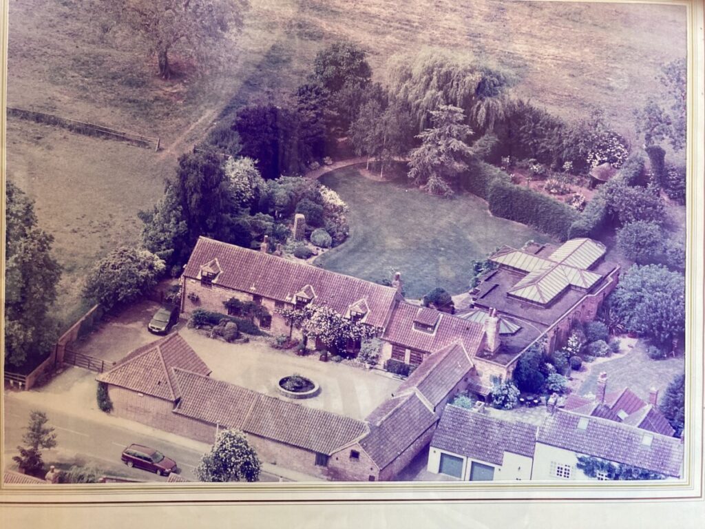
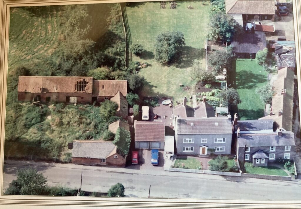
The Olde Barn, Main St
We are very grateful to Mrs Tina Combellack for sharing the following aerial photographs of The Olde Barn which track this part of the village over 50 years:
From the Wadkin Archives:
Aerial photographs from the Wadkin Archives.
")
")


")


")
")
")
")
")
")
")