Bench Marks are an intriguing feature which are found carved in to the walls of all kinds of buildings and features across the country. Broadly, they form a national network of markers indicating heights above sea level and also indicate relative heights within a locality against each other – each site should be firmly anchored to bedrock.
If you have a bench mark on your property or have spotted one in a public place, please get in touch (see the table, below, for OS grid refs). If you can let us have precise location details and photographs we can add them to our website and improve our records – thank you!
They are defined by Ordnance Survey as:
“Ordnance Survey Bench marks (BMs) are survey marks made by Ordnance Survey to record height above Ordnance Datum. If the exact height of one BM is known, the exact height of the next can be found by measuring the difference in heights, through a process of spirit levelling.
“Most commonly, the BMs are found on buildings or other semi-permanent features. Although the main network is no longer being updated, the record is still in existence and the markers will remain until they are eventually destroyed by redevelopment or erosion.
“Bench marks are the visible manifestation of Ordnance Datum Newlyn (ODN), which is the national height system for mainland Great Britain and forms the reference frame for heights above mean sea level. ODN is realised on the ground by a network of approximately 190 fundamental bench marks (FBMs). From these FBMs tens of thousands of lower-order BMs were established. The network has had little maintenance for 30 years, and in some areas (mining areas for example), subsidence has affected the levelling values. In these regions the BMs cannot be relied upon to accurately define ODN.
“There are approximately 500 000 ‘lower order’ BMs still remaining. This number is reducing due to property development, road widening and so on. The BM heights shown have not been maintained for 30 years and should not be relied upon to accurately define ODN.
“There are approximately 190 FBMs, which as the name suggests are our high-accuracy BMs. These are still maintained and are still used by Ordnance Survey. They form our primary height network and, as such, are our link to the Ordnance Datum at Newlyn. They are used in the creation of the orthometric to GPS height correction model (OSTN15). The FBMs are not available through this website. Access to FBM values will be considered on a case by case basis on application to Ordnance Survey.”
https://www.ordnancesurvey.co.uk/benchmarks/
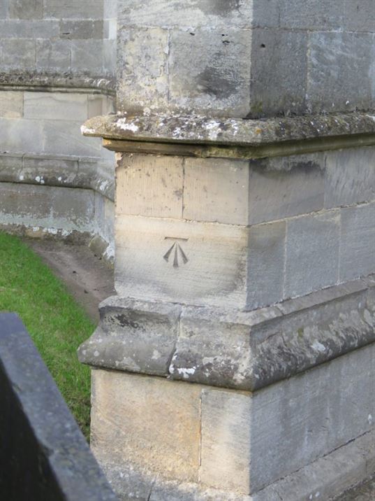
St. Luke’s Parish Church:


Sycamore Lodge:
Benchmark on the wall of Sycamore Lodge, Green Lane
Benchmark on the wall of Sycamore Lodge, Green Lane
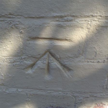
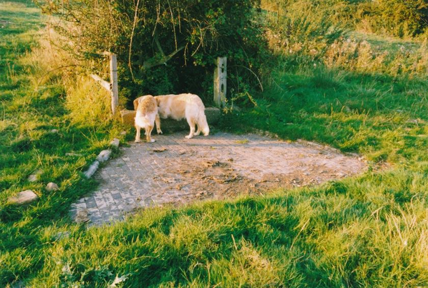
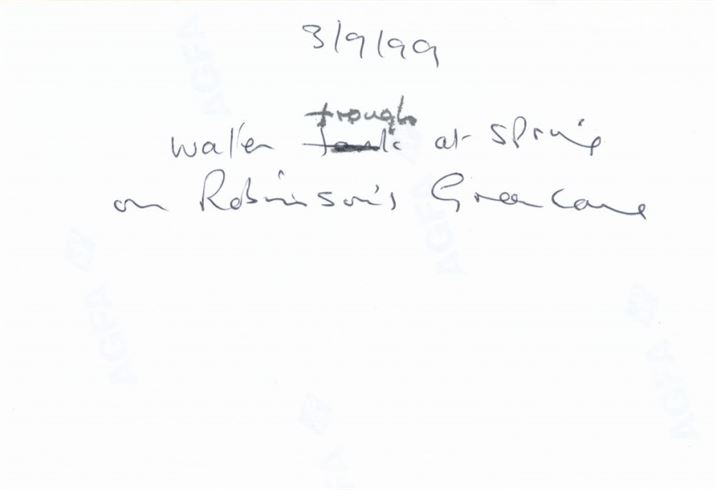
Stone Trough, Spring, north of Green Lane:

Wadkin Archive; W0890b

Wadkin Archive; W0890bb
Wolds Cottage, Bridegate Lane.
The Olde Barn, Main Street.


This benchmark can be found on the roadside of The Olde Barn nearest to Beech House about two feet from the corner and about two feet up (close to the junction of Main Street and Clawson Lane).
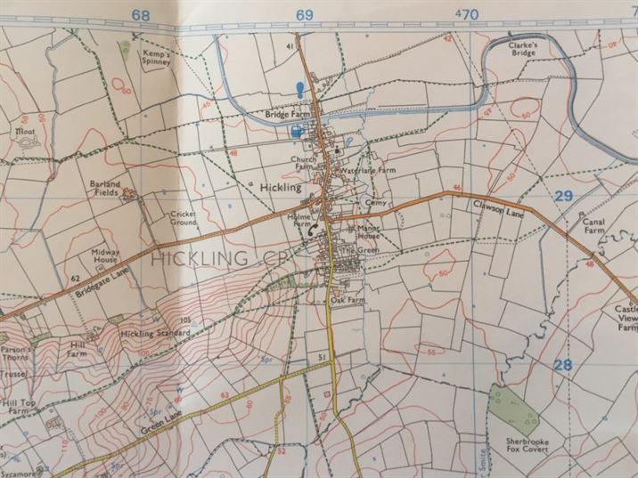
OS Benchmarks: listings local to Hickling – click here
We are still working on the Hickling OS marks; however, at the moment it is our understanding that there are 6 benchmarks in Hickling and Hickling Pastures although it is thought that the one on Manor Cottages, Hickling Pastures has been lost. In addition, there is an OS rivet on the Bridegate Lane boulder and a trig point on the Hickling Standard.
There are some really useful websites that are supporting research in to remaining bench marks:
An Ordnance Survey Blog: Keeping our fundamental bench marks in order:
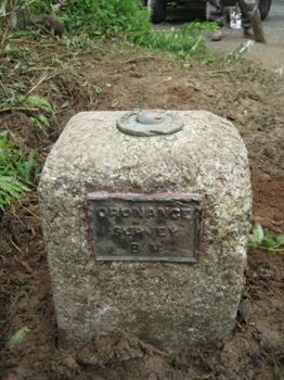
“Most people are familiar with trig pillars. There are over 7,000 of them scattered around Great Britain. However, there is another, considerably more elusive, type of pillar to be seen across the land – the fundamental bench mark (FBM). FBMs are the physical realisation of our national height datum ‘Ordnance Datum Newlyn’ (ODN – mean sea level at Newlyn, Cornwall, 1915-1921) and are still crucial in defining this reference system today.
“There are nearly 200 FBMs around Great Britain, mostly constructed in the first half of the twentieth century at sites carefully selected to provide an anchor to bedrock. The height of each FBM relative to ODN was determined by a network of precise levelling lines across the country. The levelling network was then densified with approximately three-quarters of a million bench marks, using less precise levelling. These lower-order bench marks are often seen cut into stone at the base of a building, church or bridge and about half a million of them are still in existence today.”
(For Hickling, there is a trig point on the top of the Hickling Standards)
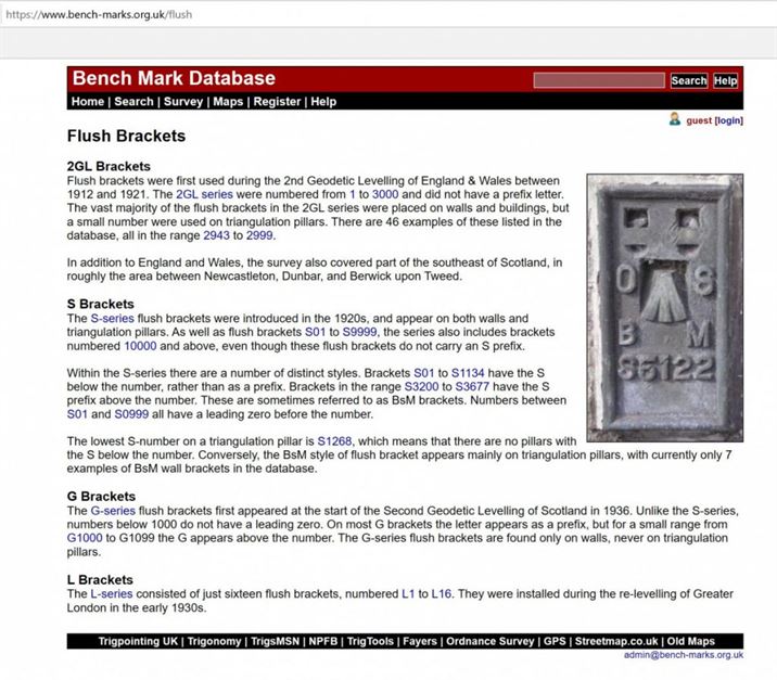
Benchmark or trig pillar: what’s in a name?
An illustrated Ordnance Survey article detailing the differences between benchmarks, fundamental benchmarks, flush brackets and trig points: click the title, above, to read this.
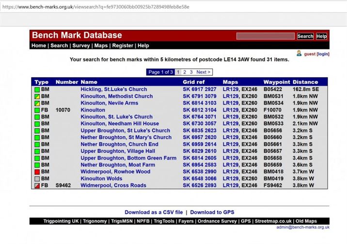
https://www.bench-marks.org.uk/viewsearch?q=fe9730060bb00925b7289498feb8e58e
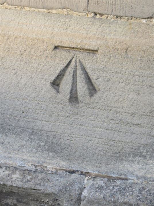
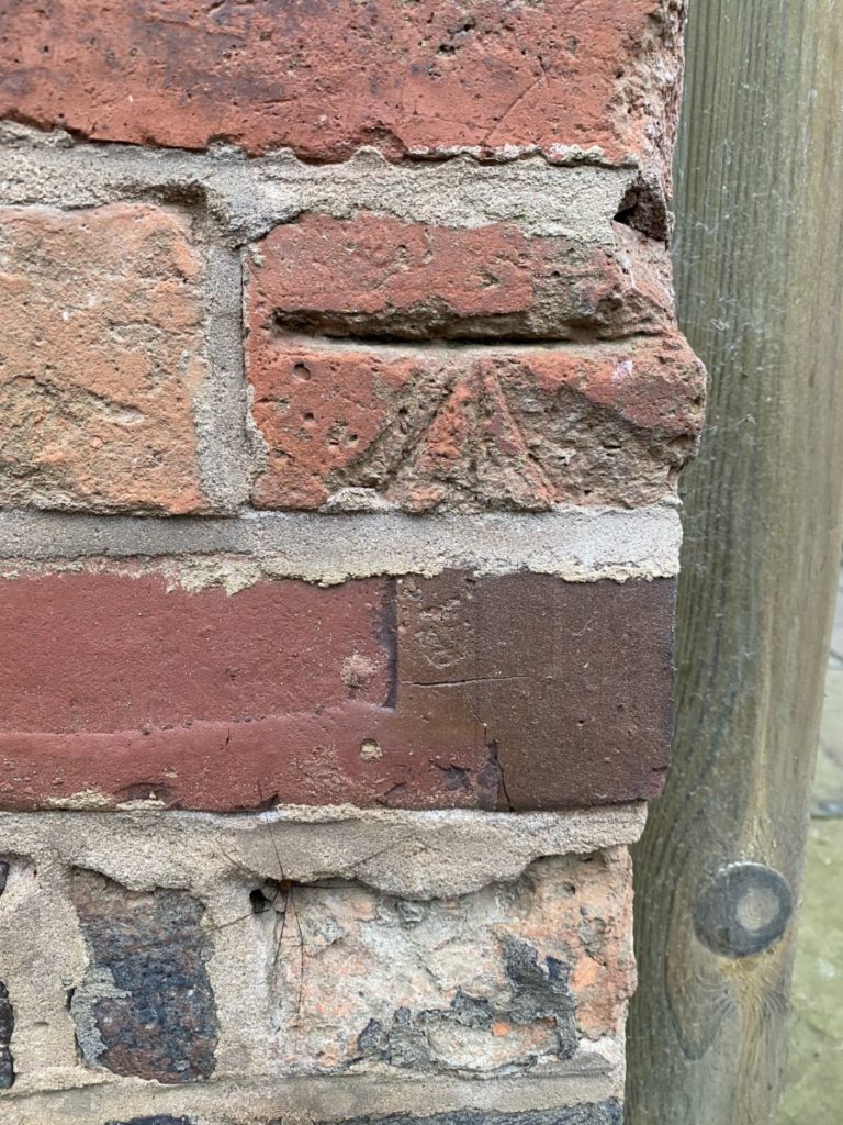
The term benchmark, or bench mark, originates from the chiseled horizontal marks that surveyors made in stone structures, into which an angle-iron could be placed to form a “bench” for a leveling rod, thus ensuring that a leveling rod could be accurately repositioned in the same place in the future. These marks were usually indicated with a chiseled arrow below the horizontal line.
The term is generally applied to any item used to mark a point as an elevation reference. Frequently, bronze or aluminum disks are set in stone or concrete, or on rods driven deeply into the earth to provide a stable elevation point. If an elevation is marked on a map, but there is no physical mark on the ground, it is a spot height.
The height of a benchmark is calculated relative to the heights of nearby benchmarks in a network extending from a fundamental benchmark. A fundamental benchmark is a point with a precisely known relationship to the vertical datum of the area, typically mean sea level. The position and height of each benchmark is shown on large-scale maps.