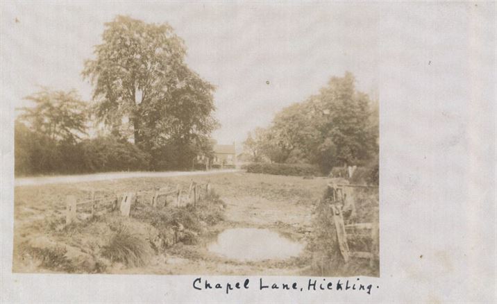
The Washpit (also known as the Weir) was sited at the entrance to the village on the south side of what is now known as Bridegate Lane (previously Smithfield Lane and Chapel Lane). It was used to clean the hooves of horses and wheels of carts as they entered the village – it was filled in in the late 1950s/early 1960s.
Right back to Domesday, Hickling has been known for being a little boggy and for flooding; the water table is generally very close to the surface. The pit was probably filled from the water table but if anyone has more or better info, we’d love to hear from you!
Although we have clear evidence of the Washpit on Bridegate Lane it is possible that there were washpits on other entrances to the village; maps show a Washpit Lane on the road to Nether Broughton, for instance. Once again, if you have any photographs or information that will help us look into this further, please use the contact button.
Washpit Lane (between Pudding lane & Green Lane):
The lane is shown, but not labelled, on the 1774 Enclosure Map
")
")
")
")
")
")


